

Minnesota map
Minnesota map
Things to do inside the boundary: Adventure Zone Duluth, Aerial Lift Bridge and American Swedish Institute. Also on it: Agassiz National Wildlife Refuge, Badoura State Forest and Bear Island State Forest. Just past the edge: Appleton, Eau Claire and Fargo.
Open the map (PDF, US Letter)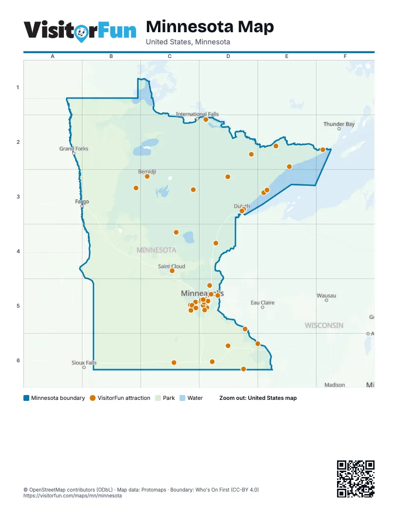
Maps inside Minnesota
5 maps inside, from the street map of Minnesota down.
Things to do on the Minnesota map
- Adventure Zone Duluth
- Aerial Lift Bridge
- American Swedish Institute
- ArtReach St. Croix
- Bell Museum
- Boundary Waters Canoe Area Wilderness
- Canal Park
- Cathedral of Saint Paul
- Como Park Zoo & Conservatory
- Duluth Entertainment Convention Center (DECC)
- Eagan
- Explore Minnesota Tourism Office
- First Avenue
- General Store of Minnetonka
- Glensheen Mansion
- Gooseberry Falls State Park
- Grand Portage National Monument
- Great Lakes Aquarium
- Guthrie Theater
- Historic Fort Snelling
- Historic Mayowood
- History Center of Olmsted County
- International Wolf Center
- Iron Range
- Itasca State Park
- James J. Hill House
- Jolly Green Giant Statue
- Judy Garland Museum
- Lutsen Mountains
- Mall of America
- Midtown Global Market
- Mill City Museum
- Minneapolis Chain of Lakes Regional Park
- Minneapolis Institute of Art
- Minnehaha Regional Park
- Minnesota Goose Garden
- Minnesota History Center
- Minnesota Landscape Arboretum
- Minnesota Renaissance Festival
- Minnesota State Capitol
- Minnesota Zoo
- Niagara Cave
- North Shore Scenic Railroad
- Padelford Riverboats
- Paisley Park
- Paul Bunyan and Babe the Blue Ox
- Paul Bunyan Land
- Running Aces Casino, Hotel & Racetrack
- Schubert Club
- Science Museum of Minnesota
- SPAM Museum
- Split Rock Lighthouse
- Spoonbridge and Cherry
- St. Cloud
- Stone Arch Bridge
- Target Field
- The Basilica of Saint Mary
- U.S. Bank Stadium
- Valleyfair
- Voyageurs National Park
- Wabasha
- Walker Art Center & Minneapolis Sculpture Garden
- Weisman Art Museum
- White Bear Lake
- Winona
Places on the map
- Agassiz National Wildlife Refuge
- Badoura State Forest
- Bear Island State Forest
- Beltrami Island State Forest
- Big Fork State Forest
- Big Stone Lake State Park
- Black Duck State Forest
- Blackduck State Forest
- Blandin Industrial Forest
- Bowstring State Forest
- Buena Vista State Forest
- Burntside State Forest
- Camp Ripley
- Carlos Avery Wildlife Management Area
- Chengwatana State Forest
- Chippewa National Forest
- Cloquet Valley State Forest
- Crow Wing State Forest
- Finland State Forest
- Fond Du Lac State Forest
- Foot Hills State Forest
- Foothills State Forest
- George Washington State Forest
- Gichigami Ziibi WMA
- Grand Portage State Forest
- Hill River State Forest
- Huntersville State Forest
- Kabetogama State Forest
- Koochiching State Forest
- Lake of the Woods State Forest
- Land O'Lakes State Forest
- Lost River State Forest
- Lyons State Forest
- Main Unit
- Minnesota Valley National Wildlife Refuge
- Mississippi Headwaters State Forest
- Nemadji State Forest
- Northwest Angle State Forest
- Pat Bayle State Forest
- Paul Bunyan State Forest
Next to Minnesota
- Appleton
- Eau Claire
- Fargo
- Grand Forks
- Sioux Falls
- Thunder Bay
- Wausau
© OpenStreetMap contributors (ODbL) · Map data: Protomaps · Boundary: Who's On First (CC-BY 4.0)