

North Carolina road map
I-74 in North Carolina map
I-74 is about 136 miles in North Carolina, in 3 separate stretches. It meets 30 highways; US 311, US 74 and NC 89 meet it in the most grid squares. Towns along it: Asheboro, Lumberton and Mount Airy.
Open the map (PDF, US Letter)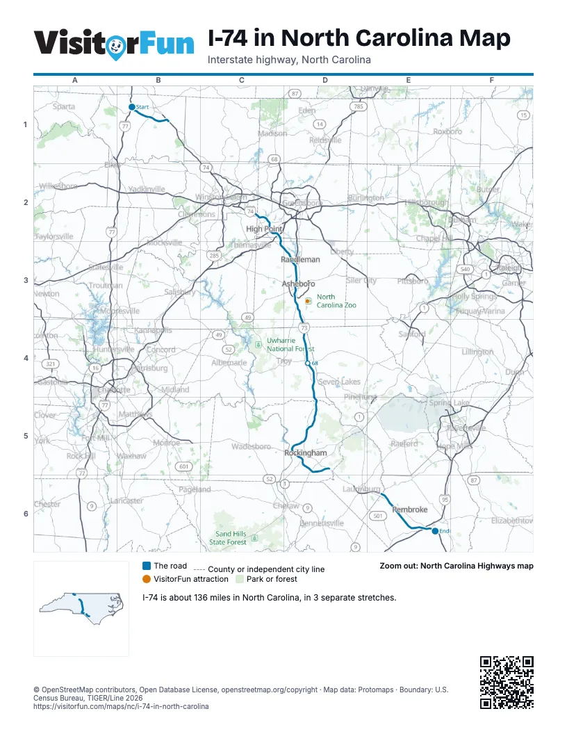
Highways I-74 meets
Each highway it meets and the grid squares where they meet.
- NC 89B1
- US 601B1
- US 52B1
- US 311B1, D3
- NC 66C2
- NC 68C2
- US 29C2
- US 70C2
- I-85C2
- NC 62C2
- I-73D3
- US 220D3
- NC 49D3
- US 64D3
- NC 2842D3
- NC 134D3
- NC 1500D4
- NC 27D4
- NC 24D4
- NC 211D4
- NC 73D5
- US 74D5, E6
- NC 177D5
- NC 38D5
- NC 381D5
- NC 130D5
- NC 71D5
- NC 710E6
- I-95E6
- US 301E6
Towns along I-74 in North Carolina
In mile order, with the grid square of each.
- Mount Airymile 6, B1
- White Plainsmile 6, B1
- Kernersvillemile 12, B1
- High Pointmile 15, C2
- Archdalemile 24, C2
- Randlemanmile 34, D3
- Asheboromile 37, D3
- Seagrovemile 54, D4
- Starmile 64, D4
- Biscoemile 66, D4
- Candormile 71, D4
- Ellerbemile 88, D5
- Cordovamile 102, D5
- Rockinghammile 103, D5
- East Rockinghammile 103, D5
- Hamletmile 108, D5
- Maxtonmile 114, D5
- Elrodmile 124, E6
- Lumbertonmile 133, E6
© OpenStreetMap contributors, Open Database License, openstreetmap.org/copyright · Map data: Protomaps · Boundary: U.S. Census Bureau, TIGER/Line 2026