

North Carolina road map
North Carolina highway map
22 Interstate routes run about 1,529 miles in North Carolina, each on a sheet of its own. The sheet's index lists 72 highways; US 64, US 74 and I-40 cross the most grid squares. Towns on it: Charlotte, Raleigh and Greensboro.
Open the map (PDF, US Letter)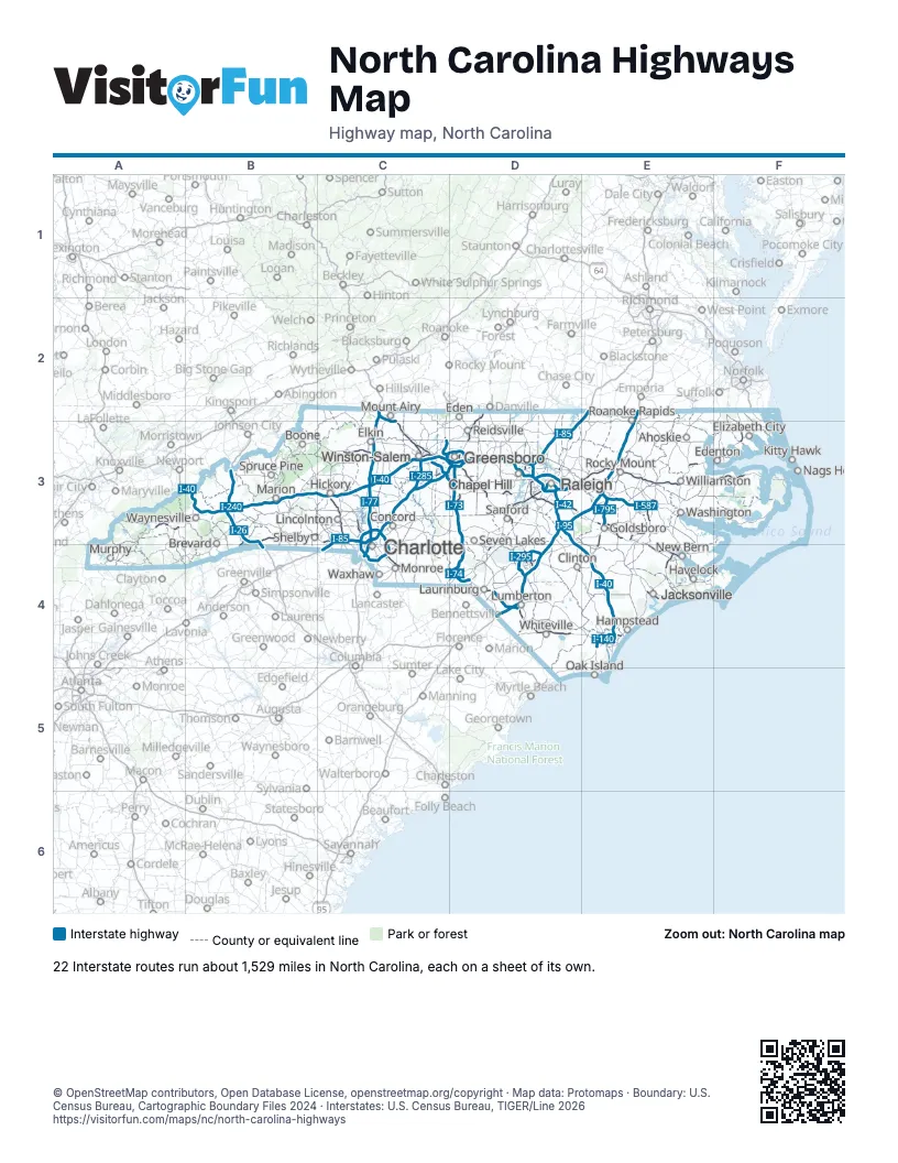
Road maps of North Carolina
18 road maps: each Interstate and byway on a sheet of its own.
- I-26 in North Carolina
- I-40 in North Carolina
- I-73 in North Carolina
- I-74 in North Carolina
- I-77 in North Carolina
- I-85 in North Carolina
- I-95 in North Carolina
- I-140 in North Carolina
- I-240 in North Carolina
- I-277 in North Carolina
- I-285 in North Carolina
- I-295 in North Carolina
- I-440 in North Carolina
- I-485 in North Carolina
- I-540 in North Carolina
- I-587 in North Carolina
- I-840 in North Carolina
- Blue Ridge Parkway
Highway index of North Carolina
Each highway on the sheet and the grid squares it crosses.
- I-26B3, B4
- I-40B3, C3, D3, D4, E4
- I-42D3, E3
- I-73C3, D3, D4
- I-74C2, C3, D3, D4
- I-77C2, C3, C4
- I-85C3, C4, D3, E2
- I-87D3
- I-95D3, D4, E2, E3
- I-97E4
- I-140E4
- I-240B3
- I-277C3, C4
- I-285C3
- I-295D4
- I-397E4
- I-440D3
- I-485C3, C4
- I-540D3
- I-587E3
- I-785D3
- I-795E3
- I-840C3, D3
- I-885D3
- US 1D3, D4
- US 13D4, E3
- US 15D3
- US 17E3, E4, F3
- US 19B3
- US 21C3, C4
- US 23A3, B3
- US 25B3, B4
- US 29C3, C4, D2, D3
- US 52C2, C3
- US 58D2
- US 64A3, B3, C3, D3, E3, F3
- US 70B3, C3, D3, E3, E4
- US 74A3, B3, C3, C4, D4, E4
- US 74AB3
- US 76D4, E4
- US 117E3, E4
- US 158C3, D3, E2, E3
- US 220C3, D3, D4
- US 258E3
- US 264D3, E3
- US 301D4
- US 321C3
- US 401D4
- US 421C3, D3, D4, E4
- US 501D3, D4
- US 601C3
- US 701D4
- NC 8C3
- NC 11E3
- NC 16C3, C4
- NC 24D4, E4
- NC 27C4
- NC 43E3
- NC 53E4
- NC 86D3
- NC 87D3, D4
- NC 111E3
- NC 130D4
- NC 133E4
- NC 140E4
- NC 147D3
- NC 148E3
- NC 150C3
- NC 192C3
- NC 540D3
- NC 885D3
- SR 9000B3, C3
Places on the map
- Ahoskie
- Boone
- Brevard
- Chapel Hill
- Charlotte
- Clinton
- Concord
- Eden
- Edenton
- Elizabeth City
- Elkin
- Goldsboro
- Greensboro
- Hampstead
- Havelock
- Hickory
- Jacksonville
- Kitty Hawk
- Laurinburg
- Lincolnton
- Lumberton
- Marion
- Monroe
- Mount Airy
- Murphy
- New Bern
- Oak Island
- Raleigh
- Reidsville
- Roanoke Rapids
- Rocky Mount
- Sanford
- Seven Lakes
- Shelby
- Spruce Pine
- Washington
- Waxhaw
- Waynesville
- Whiteville
- Williamston
- Winston-Salem
© OpenStreetMap contributors, Open Database License, openstreetmap.org/copyright · Map data: Protomaps · Boundary: U.S. Census Bureau, Cartographic Boundary Files 2024 · Interstates: U.S. Census Bureau, TIGER/Line 2026