

North Dakota map
Grand Forks Township map
About 59,845 people live here (Census Bureau, 2024 estimate). The sheet's index lists 34 streets; 62nd Avenue South, 12th Avenue Northeast and South 42nd Street cross the most grid squares. Also on it: Grand Forks Country Club.
Open the map (PDF, US Letter)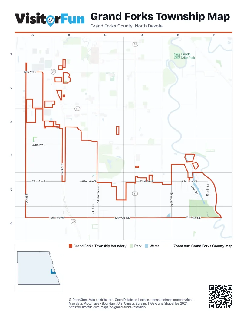
Street index of Grand Forks Township
Each street on the sheet and the grid squares it crosses.
- 17th Avenue SouthA2
- 32nd Avenue SouthA3
- South 42nd StreetB3, B4, B5, B6
- South 19th StreetC3
- Tobi LaneC3
- 47th Avenue SouthA4, B4, C4
- Shady Ridge CourtE4, F4
- 55th Street SouthA5, A6
- 62nd Avenue SouthA5, B5, C5, D5, E5
- 29th Street SouthC5, C6
- 69th Avenue SouthC5
- Kings View DriveC5
- South Columbia RoadC5, C6
- South Washington StreetD5, D6
- 62nd Avenue SoutheastE5, F5
- Angela DriveE5
- Belmont RoadE5, E6
- Driftwood DriveE5
- Hillcrest StreetE5, F5
- Lake DriveE5, F5
- Oakfield DriveE5, F5
- Sandalwood DriveE5
- Woodcrest RoadE5
- 16th Street SoutheastF5
- 8th StreetF5
- East Lake DriveF5
- 74th Avenue SouthA6
- 12th Avenue NortheastB6, C6, D6, E6, F6
- 12th Street NortheastB6
- 73rd Avenue SouthC6
- Country Side LaneC6
- South 25th StreetC6
- 10th Street NortheastD6
- 8th Street NortheastF6
Places on the map
- Grand Forks Country Club
© OpenStreetMap contributors, Open Database License, openstreetmap.org/copyright · Map data: Protomaps · Boundary: U.S. Census Bureau, TIGER/Line Shapefiles 2024