

North Dakota road map
North Dakota highway map
2 Interstate routes run about 564 miles in North Dakota, each on a sheet of its own. The sheet's index lists 10 highways; I-94, I-29 and US 81 cross the most grid squares. Towns on it: Fargo, Bismarck and Grand Forks.
Open the map (PDF, US Letter)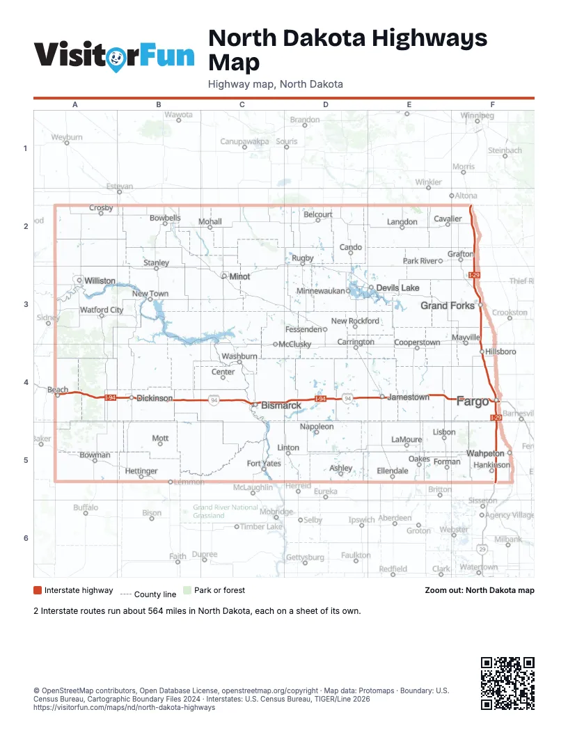
Road maps of North Dakota
2 road maps: each Interstate and byway on a sheet of its own.
Highway index of North Dakota
Each highway on the sheet and the grid squares it crosses.
- I-29F2, F3, F4, F5
- I-94A4, B4, C4, D4, E4, F4
- US 2C3
- US 52C3, E4, F4
- US 81F2, F3, F4, F5
- US 83C3, C4, D4
- US 281E4
- ND 1E4
- ND 3D4
- ND 22B4
Places on the map
- Ashley
- Beach
- Belcourt
- Bismarck
- Bowbells
- Bowman
- Cando
- Carrington
- Cavalier
- Center
- Cooperstown
- Crosby
- Devils Lake
- Dickinson
- Ellendale
- Fargo
- Fessenden
- Forman
- Fort Yates
- Grafton
- Grand Forks
- Hankinson
- Hettinger
- Hillsboro
- Jamestown
- LaMoure
- Langdon
- Linton
- Lisbon
- Mayville
- McClusky
- Minnewaukan
- Minot
- Mohall
- Mott
- Napoleon
- New Rockford
- New Town
- Oakes
- Park River
- Rugby
- Stanley
- Wahpeton
- Washburn
- Watford City
- Williston
© OpenStreetMap contributors, Open Database License, openstreetmap.org/copyright · Map data: Protomaps · Boundary: U.S. Census Bureau, Cartographic Boundary Files 2024 · Interstates: U.S. Census Bureau, TIGER/Line 2026