

Nebraska road map
Nebraska highway map
6 Interstate routes run about 474 miles in Nebraska, each on a sheet of its own. The sheet's index lists 13 highways; I-80, US 34 and US 75 cross the most grid squares. Towns on it: Omaha, Lincoln and Grand Island.
Open the map (PDF, US Letter)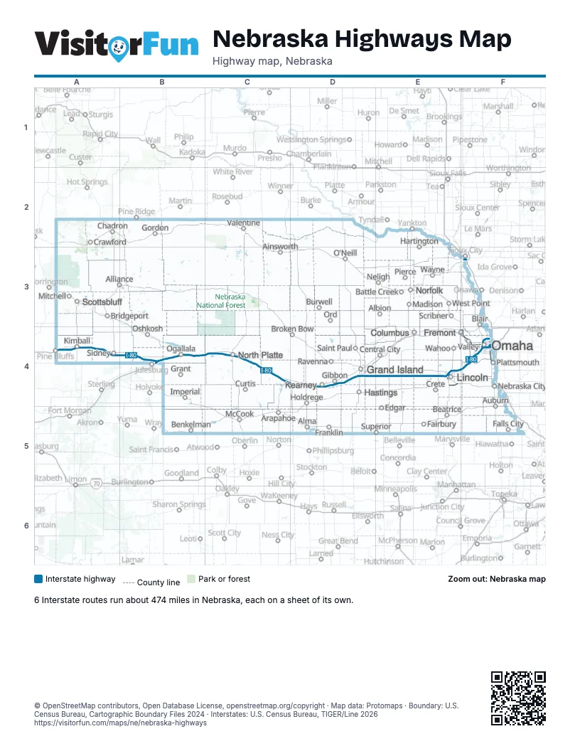
Road maps of Nebraska
6 road maps: each Interstate and byway on a sheet of its own.
Highway index of Nebraska
Each highway on the sheet and the grid squares it crosses.
- I-76B4
- I-80A4, B4, C4, D4, E4, F4
- I-129F3
- I-180E4
- I-480F4
- I-680F4
- US 6F4
- US 20F3
- US 30F4
- US 34E4, F4
- US 75F3, F4
- US 77E4, F4
- US 275F4
Places on the map
- Ainsworth
- Albion
- Alliance
- Alma
- Arapahoe
- Auburn
- Battle Creek
- Beatrice
- Benkelman
- Blair
- Bridgeport
- Broken Bow
- Burwell
- Central City
- Chadron
- Columbus
- Crawford
- Crete
- Curtis
- Edgar
- Fairbury
- Falls City
- Franklin
- Fremont
- Gibbon
- Gordon
- Grand Island
- Grant
- Hartington
- Hastings
- Holdrege
- Imperial
- Kearney
- Kimball
- Lincoln
- Madison
- McCook
- Mitchell
- Nebraska City
- Neligh
- Norfolk
- North Platte
- O'Neill
- Ogallala
- Omaha
- Ord
- Oshkosh
- Pierce
- Plattsmouth
- Ravenna
- Saint Paul
- Scottsbluff
- Scribner
- Sidney
- Superior
- Valentine
- Valley
- Wahoo
- Wayne
- West Point
© OpenStreetMap contributors, Open Database License, openstreetmap.org/copyright · Map data: Protomaps · Boundary: U.S. Census Bureau, Cartographic Boundary Files 2024 · Interstates: U.S. Census Bureau, TIGER/Line 2026















