

Nebraska map
Northeast Nebraska map
The sheet's index lists 8 highways; US 30, US 275 and US 20 cross the most grid squares. Things to do inside the boundary: Ashfall Fossil Beds State Historical Park and John G. Neihardt State Historic Site. Also on it: Albion, Atkinson and Battle Creek.
Open the map (PDF, US Letter)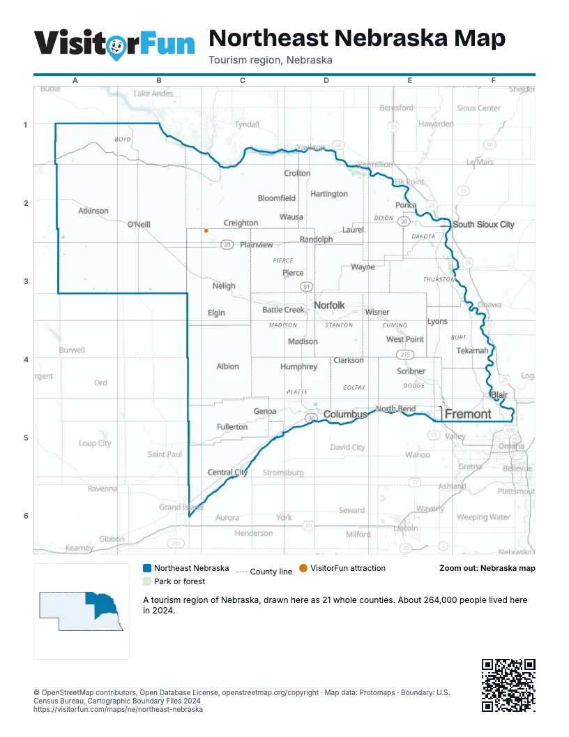
Highway index of Northeast Nebraska
Each highway on the sheet and the grid squares it crosses.
- I-129E2
- US 20A2, B2, B3, C3, D2, E2
- US 30B6, C5, C6, D5, E5, F4, F5
- US 75E2, F4
- US 77E2, E4, E5
- US 81D1, D2, D3, D4, D5
- US 275B2, B3, C3, D3, E3, E4, E5
- US 281B2
Things to do on the Northeast Nebraska map
Places on the map
- Albion
- Atkinson
- Battle Creek
- Blair
- Bloomfield
- Central City
- Clarkson
- Columbus
- Creighton
- Crofton
- Elgin
- Fremont
- Fullerton
- Genoa
- Hartington
- Humphrey
- Laurel
- Lyons
- Madison
- Neligh
- Norfolk
- North Bend
- O'Neill
- Pierce
- Plainview
- Ponca
- Randolph
- Scribner
- South Sioux City
- Tekamah
- Wausa
- Wayne
- West Point
- Wisner
Next to Northeast Nebraska
- Lakes and Land
- Loess Hills and Beyond
- Metro Nebraska map
- Sandhills Nebraska map
- South Central Nebraska map
- Southeast Nebraska map
- Missouri River
- Southeast South Dakota
© OpenStreetMap contributors, Open Database License, openstreetmap.org/copyright · Map data: Protomaps · Boundary: U.S. Census Bureau, Cartographic Boundary Files 2024