

New Jersey map
Cape May County map
About 93,875 people live here (Census Bureau, 2024 estimate). The sheet's index lists 12 streets; Garden State Parkway, GSP NB Exit 25 and GSP Northbound entrance cross the most grid squares. Things to do inside the boundary: Aqua Action Watersports, Atlantic Parasail and Bayview Watersports Marina.
Open the map (PDF, US Letter)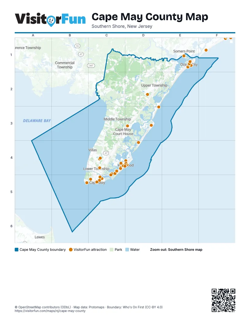
Maps inside Cape May County
4 maps inside, from the street map of Cape May County down.
Cities
Street index of Cape May County
Each street on the sheet and the grid squares it crosses.
- Garden State ParkwayE1, D2, E2, C3, D3, C4
- GSP NB Exit 25E1
- GSP Northbound entranceE1
- GSP NB Entrance 17D2
- GSP NB Exit 20D2
- GSP SB Entrance 20D2
- GSP SB Exit 17D2
- GSP NB Entrance 13D3
- GSP NB Exit 13D3
- GSP SB Entrance 11D3
- GSP SB Entrance 12D3
- GSP SB Exit 11D3
Things to do on the Cape May County map
- Aqua Action Watersports
- Atlantic Parasail
- Bayview Watersports Marina
- Cape May Brewing Company
- Cape May Fisherman
- Cape May Historic District
- Cape May Lighthouse
- Cape May Whale Watcher
- Carini Pizza & Italian Restaurant
- Cloak & Dagger Escape Rooms
- Downtown Wildwood Business Improvement District
- Historic Cold Spring Village
- Johnson's Popcorn
- Maple's Bakeshop
- Marvis Diner
- Miss Avalon Fishing Boat
- Mocean Waverunners
- Morey's Piers
- MudHen Brewing Co.
- NAS Wildwood Aviation Museum
- OC Waterpark
- Ocean View Resort Campground
- OCNJ Watersports Aqua Park
- Pier 47 Marine
- Primo Hoagies
- Revolution Rail Co.
- Sal's Pizza
- Salt Marsh Safari
- Sea Isle City
- Seventh Street Surf Shop
- Stone Harbor
- The Bagel Depot
- The Beachy Tiki
- The Wildwoods
- The Yard
- Thunder Cat Dolphin Watch
- Totally Tubular Watersports
- Wildwood Golf Cart Rental and Sales
- Wildwood Rental Supply
- Wildwoods Boardwalk
- Willow Creek Winery
Places on the map
- Angelsea Marsh
- Avalon
- Beaver Swamp Wildlife Management Area
- Beesleys Point
- Belleplain
- Belleplain State Forest
- Blackman Island
- Burleigh
- Cape Island Resort
- Cape May
- Cape May Coastal Wetlands Wildlife Management Area
- Cape May County
- Cape May Court House
- Cape May Golf Club
- Cape May Housing
- Cape May National Wildlife Refuge
- Cape May Point
- Cape May Point State Park
- Clubhouse Lagoon
- Cold Spring Harbor
- Corson's Inlet State Park
- Cowpens Island
- Dennis Creek Wildlife Management Area
- Dennis Township
- Dennisville
- Diamond Beach
- East Creek Pond
- Eldora Nature Preserve
- Erma
- Five Mile Beach
- Goshen
- Grassy Sound
- Grassy Sound Meadow
- Great Flat
- Gull Bar
- Hann Cove
- Hawk Haven Vineward and Winery
- Hildreth Meadow
- Jacobs Creek
- Johnson Pond
Next to Cape May County
- Commercial Township
- Downe Township
- Lawrence Township
- Lewes
- Somers Point
- Ventnor City
© OpenStreetMap contributors (ODbL) · Map data: Protomaps · Boundary: Who's On First (CC-BY 4.0)