

New Mexico map
Albuquerque Metro Area map
The sheet's index lists 7 highways; I-40, US 66 and US 550 cross the most grid squares. Things to do inside the boundary: ABQ BioPark, Albuquerque International Balloon Fiesta and Anderson Abruzzo Albuquerque International Balloon Museum. Also on it: Albuquerque, Belen and Estancia.
Open the map (PDF, US Letter)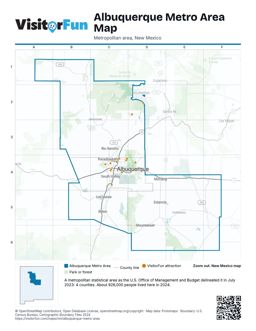
Highway index of Albuquerque Metro Area
Each highway on the sheet and the grid squares it crosses.
- I-25C3, C4, C5, D3
- I-40B4, C4, D4, E4, F4
- US 60F5
- US 66B4, C4, D4, E4, F4
- US 285E4, E5, F5
- US 550A1, B1, B2, C2, C3
- NM 423C4
Things to do on the Albuquerque Metro Area map
- ABQ BioPark
- Anderson Abruzzo Albuquerque International Balloon Museum
- Bandelier National Monument
- Belen Harvey House Museum
- Breaking Bad RV Tours
- Coronado Center
- Cottonwood Mall
- Indian Pueblo Cultural Center
- Isleta Resort & Casino
- Kasha-Katuwe Tent Rocks National Monument
- National Museum of Nuclear Science and History
- New Mexico Museum of Natural History and Science
- Old Town Albuquerque
- Sandia Peak Aerial Tramway
- Sandia Resort & Casino
- Turquoise Trail
- Warpath Traders
- World Balloon
Places on the map
- Albuquerque
- Belen
- Estancia
- Los Lunas
- Moriarty
- Mountainair
- Paradise Hills
- Rio Rancho
- South Valley
© OpenStreetMap contributors, Open Database License, openstreetmap.org/copyright · Map data: Protomaps · Boundary: U.S. Census Bureau, Cartographic Boundary Files 2024