

New York map
Ferry Point Park map
A printable two-page map of Ferry Point Park (The Bronx, New York), drawn by VisitorFun from OpenStreetMap. Page two is the street index: every street on the sheet with its grid square, the same list as below.
Open the map (PDF, US Letter)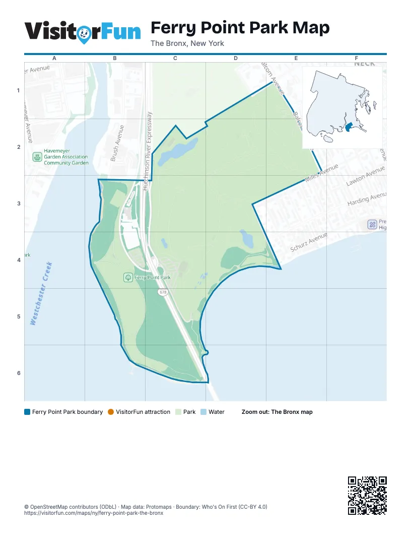
Street index of Ferry Point Park
Each street on the sheet and the grid squares it crosses.
- Butterick AvenueD1
- Schley AvenueD1
- Hutchinson River ExpresswayB3, B4, C4
- Hutchinson River Parkway Service RoadB3, C3, B4, C4
- Emerson AvenueD3, E4
- Miles AvenueD3
- Bronx-Whitestone BridgeC4, C5
- Ferry Point Park Service RoadC4, C5
- Harding AvenueE4
- Schurz AvenueE4
Places on the map
- Bally's Golf Links at Ferry Point
- Ferry Point Park
© OpenStreetMap contributors (ODbL) · Map data: Protomaps · Boundary: Who's On First (CC-BY 4.0)