

New York map
Howland Hook map
A printable two-page map of Howland Hook (Staten Island, New York), drawn by VisitorFun from OpenStreetMap. Page two is the street index: every street on the sheet with its grid square, the same list as below.
Open the map (PDF, US Letter)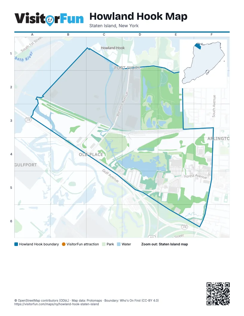
Street index of Howland Hook
Each street on the sheet and the grid squares it crosses.
- Richmond TerraceD1, E2
- Western AvenueD1, D2, C3, C4
- Benjamin PlaceE2
- Macormac PlaceE2
- New York Container Terminal DrivewayC3, B4
- Arlington PlaceE3
- Holland AvenueE3, E4
- South AvenueF3, F5
- Goethals Road NorthB4, C4, D5, E6, F6
- North Washington AvenueB4, C4
- Kinsey PlaceE4, F4
- Woodcliff AvenueE4, E5
- Cable WayF4
- Dolson PlaceF4
- Northfield AvenueF4, F5
- Forest AvenueD5, E5, F5
- Meeker AvenueD5
- Morrow StreetD5, E5
- Elizabeth Grove RoadE5
- Dwarf StreetF5
- Lilac CourtF5
- Wemple StreetF5
- Wolkoff LaneF6
Places on the map
- Asian Food
- BJ's Wholesale Club
- Goethals Community
- Goethals Pond
- Goethals Pond Complex State Tidal Wetland
- Graniteville Swamp Park
- Mariner's Marsh Park
- Port Liberty New York
- Public Storage
- Regal UA Staten Island & RPX
- Roman Plaza
- The Home Depot
Next to Howland Hook
- Arlington
- Gulfport
- Port Ivory
© OpenStreetMap contributors (ODbL) · Map data: Protomaps · Boundary: Who's On First (CC-BY 4.0)