

New York map
Marble Hill map
A printable two-page map of Marble Hill (Manhattan, New York), drawn by VisitorFun from OpenStreetMap. Page two is the street index: every street on the sheet with its grid square, the same list as below.
Open the map (PDF, US Letter)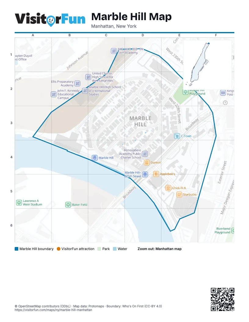
Street index of Marble Hill
Each street on the sheet and the grid squares it crosses.
- Tibbett AvenueC1, C2
- Terrace View AvenueC2, D2, C3
- Adrian AvenueD2, C3
- Marble Hill AvenueD2, E2, D3, D4
- Van Corlear PlaceD2, C3, D3
- West 227th StreetD2, D3
- West 228th StreetD2, E2, E3
- Teunissen PlaceB3, C3
- Fort Charles PlaceC3, D3
- Jacobus PlaceC3, C4
- West 225th StreetC3, C4, D4, D5, E5
- BroadwayE3, F3, D4, D5
Places on the map
- Applebee's
- Atmosphere Academy Public Charter School
- Bank of America
- Broadway Deals II
- Bronx Engineering and Technology Academy
- Bronx Theatre High School
- C-Town
- C&G Gourmet Deli
- Chick-fil-A
- China Wang
- Citi Bike - Marble Hill Ave & W 225 St
- Citi Bike - Marble Hill Ave & W 227 St
- CP 10
- Dunkin'
- Marble Hill
- Marble Hill High School of International Studies
- Marble Hill Houses
- Marble Hill Pharmacy
- Marble Hill Playground
- Marble Hill-225th Street
- Marble Hill–225th Street
- Marshalls
- Saint Stephen's Methodist Episcopal Church
- Saint Stephens English Methodist Church
- Starbucks
- Subway
- Taquería Sinaloense
- Target
- Teunissen Place
- The Children's Place
- West Kingsbridge Road & Broadway
© OpenStreetMap contributors (ODbL) · Map data: Protomaps · Boundary: Who's On First (CC-BY 4.0)