

New York map
Mount Hope map
A printable two-page map of Mount Hope (The Bronx, New York), drawn by VisitorFun from OpenStreetMap. Page two is the street index: every street on the sheet with its grid square, the same list as below.
Open the map (PDF, US Letter)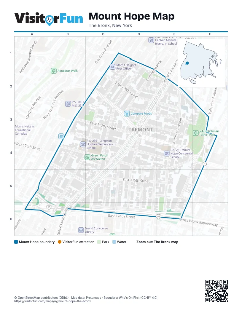
Street index of Mount Hope
Each street on the sheet and the grid squares it crosses.
- East Burnside AvenueD1, D2, E2, F3
- Walton AvenueD1, C2, C3, C4, B5, B6
- East Tremont AvenueC2, C3, D3, D4, E4, F4
- Bush StreetD2, E2
- Devanney SquareD2, E2
- East 179th StreetD2, E2, E3
- Grand ConcourseD2, E2, D3, C4, D4, B5, C5, B6
- Anthony AvenueE2, E3, E4, E5, E6
- East 177th StreetC3, D3
- Morris AvenueC3, C5, C6
- Creston AvenueD3
- East 178th StreetD3, E3, F3
- Echo PlaceD3, E3
- Ryer AvenueF3
- Valentine AvenueF3, F4
- Henwood PlaceB4, C4
- Townsend AvenueB4, A5, B5, A6
- East 176th StreetC4, D4, E4, F4, E5
- Mount Hope PlaceC4, D4, E4
- Weeks AvenueC4, C5, C6
- Clay AvenueD4, D5, D6
- Monroe AvenueD4, D5, D6
- Topping AvenueD4, D5, D6
- Carter AvenueF4, E5, F5, E6
- Webster AvenueF4
- Clifford PlaceB5
- East 175th StreetB5, C5, E5
- Eastburn AvenueC5, C6
- Prospect PlaceD5, E5
- Cross Bronx ExpresswayA6, B6, D6, E6
- East 174th StreetA6
- Cross Bronx Expressway Service RoadC6, D6
- Ittner PlaceE6
Places on the map
- 174th-175th Streets
- 176th Street
- Burnside Avenue
- Compare Foods
- Fellowship Chapel
- Green Patch on Walton
- I.S. 117 - Joseph H. Wade Academies
- Julius Richman "Echo" Park
- Kingdom Hall of Jehovahs Witnesses
- Morris Heights Post Office
- P.S. 236 - Langston Hughes Elementary School
- P.S. 28 - Mount Hope Centennial School
- Saint Edmunds Episcopal Church
- Saint Margaret Mary Catholic Church
- Tremont Avenue
- Tremont Baptist Church
- Walton Slope
© OpenStreetMap contributors (ODbL) · Map data: Protomaps · Boundary: Who's On First (CC-BY 4.0)