

New York map
Pelham Gardens map
A printable two-page map of Pelham Gardens (The Bronx, New York), drawn by VisitorFun from OpenStreetMap. Page two is the street index: every street on the sheet with its grid square, the same list as below.
Open the map (PDF, US Letter)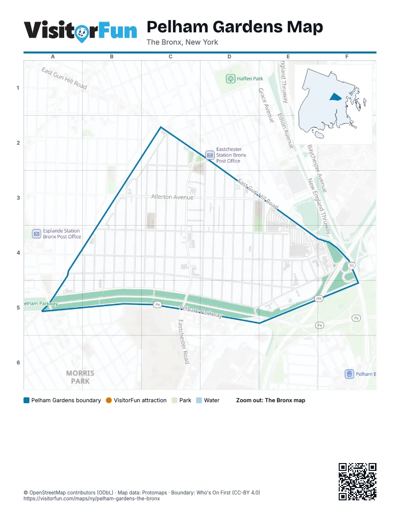
Street index of Pelham Gardens
Each street on the sheet and the grid squares it crosses.
- Arnow AvenueC2, D2
- Dewitt PlaceC2, B3
- Eastchester RoadC2, C3, C4, C5
- Fenton AvenueC2, C3, C4, C5
- Fish AvenueC2, C3, C5
- Morgan AvenueC2, C3, C4, C5
- O'Neill PlaceC2
- Seymour AvenueC2, C3, C5
- Woodhull AvenueD2, D3, D5
- Allerton AvenueB3, D3
- Bouck AvenueB3, B4, B5
- Gabriel DriveB3, B4
- Wilson AvenueB3, B4, B5
- Young AvenueB3, B5
- Bantam PlaceC3, D3
- Fielding StreetC3, D3
- Hawthorne StreetC3, D3
- Schorr PlaceC3, D3
- Kingsland AvenueD3, D4, D5
- Lodovick AvenueD3, D4, D5
- Mickle AvenueD3, D5
- Tiemann AvenueD3, D4, D5
- Westervelt AvenueD3, D5
- Gunther AvenueE3, E4, E5
- Astor AvenueA4, B4, C4, D4, D5, E5
- EsplanadeA4, B4, A5
- Hering AvenueA4, A5
- Mace AvenueB4, D4, E4
- Pearsall AvenueB4, B5
- Tenbroeck AvenueB4, B5
- Throop AvenueB4, B5
- Waring AvenueB4, D4, E4, F4
- Bruner AvenueE4, E5
- Delanoy AvenueE4, E5
- Demeyer StreetE4, E5
- Ely AvenueE4, F4
- Vance StreetE4
- Wickham AvenueE4, E5
- East Gun Hill RoadF4
- Erskine PlaceF4
- Hutchinson River ParkwayF4, F5
- New England ThruwayF4
- Stillwell AvenueF4, D5, E5
- Pelham ParkwayA5, B5, C5, D5, E5
- Pelham Parkway NorthA5, B5, C5, D5
Places on the map
- ALDI
- Chuck E. Cheese
- Eastchester Cancer Center
- Gun Hill Road
- Holy Rosary School
- J.H.S. 144 - Michelangelo Junior High School
- King’s Harbor Multicare Center
- New York Engine Company 97
- Pelham Bay Diner
- Pelham Garden Motel
- The Home Depot
- Walgreens
Next to Pelham Gardens
- Co-Op City
- Morris Park map
© OpenStreetMap contributors (ODbL) · Map data: Protomaps · Boundary: Who's On First (CC-BY 4.0)