

New York map
Pelham Parkway map
A printable two-page map of Pelham Parkway (The Bronx, New York), drawn by VisitorFun from OpenStreetMap. Page two is the street index: every street on the sheet with its grid square, the same list as below.
Open the map (PDF, US Letter)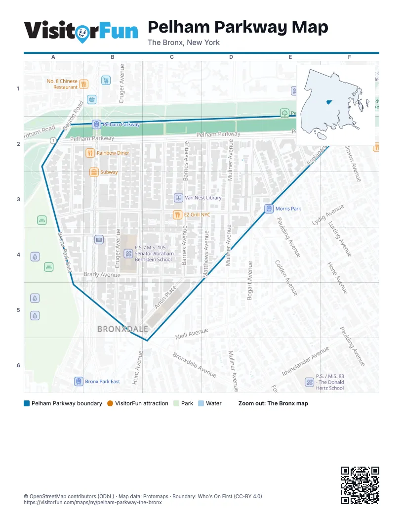
Street index of Pelham Parkway
Each street on the sheet and the grid squares it crosses.
- Pelham ParkwayF1, A2, B2, C2, D2
- Bolton StreetA2, A3
- Boston RoadA2
- East Fordham RoadA2
- Pelham Parkway SouthA2, B2, C2, D2, E2, F2
- Cruger AvenueB2, B3
- Holland AvenueB2, B3, B5
- Barnes AvenueC2, C3, C4
- Wallace AvenueC2, C3, C4, C5
- Bogart AvenueD2, D3
- Matthews AvenueD2, D3
- Muliner AvenueD2, D3
- Paulding AvenueD2, E3
- EsplanadeE2, F2, E3
- Haight AvenueE2, F2
- Hone AvenueE2, E3
- Lurting AvenueE2
- Bronx Park EastA3, A5
- Lydig AvenueB3, D3
- White Plains RoadB3, B5
- Colden AvenueD3
- Woodmansten PlaceD3, E3
- Brady AvenueA4, B4
- Maran PlaceA4, B4
- Antin PlaceC4, B5, C5
- Bronxdale AvenueA5, B5, C6
- Hunt AvenueC6
Places on the map
- Bank of America
- Bronx High School for the Visual Arts
- Bronx High School for the Visual Arts Gymnasium
- Citgo
- EZ Grill NYC
- GNC
- I Smile
- McDonald's
- Morris Park
- P.S. / M.S. 105 - Senator Abraham Bernstein School
- Pelham Parkway
- Pelham Parkway & Muliner Avenue
- Pelham Parkway & White Plains Road
- Pelham Parkway Jewish Center
- Rainbow Diner
- Subway
- TD Bank
- Van Nest Library
Next to Pelham Parkway
- Bronxdale
© OpenStreetMap contributors (ODbL) · Map data: Protomaps · Boundary: Who's On First (CC-BY 4.0)