

New York map
Roosevelt Island map
A printable two-page map of Roosevelt Island (Manhattan, New York), drawn by VisitorFun from OpenStreetMap. Page two is the street index: every street on the sheet with its grid square, the same list as below.
Open the map (PDF, US Letter)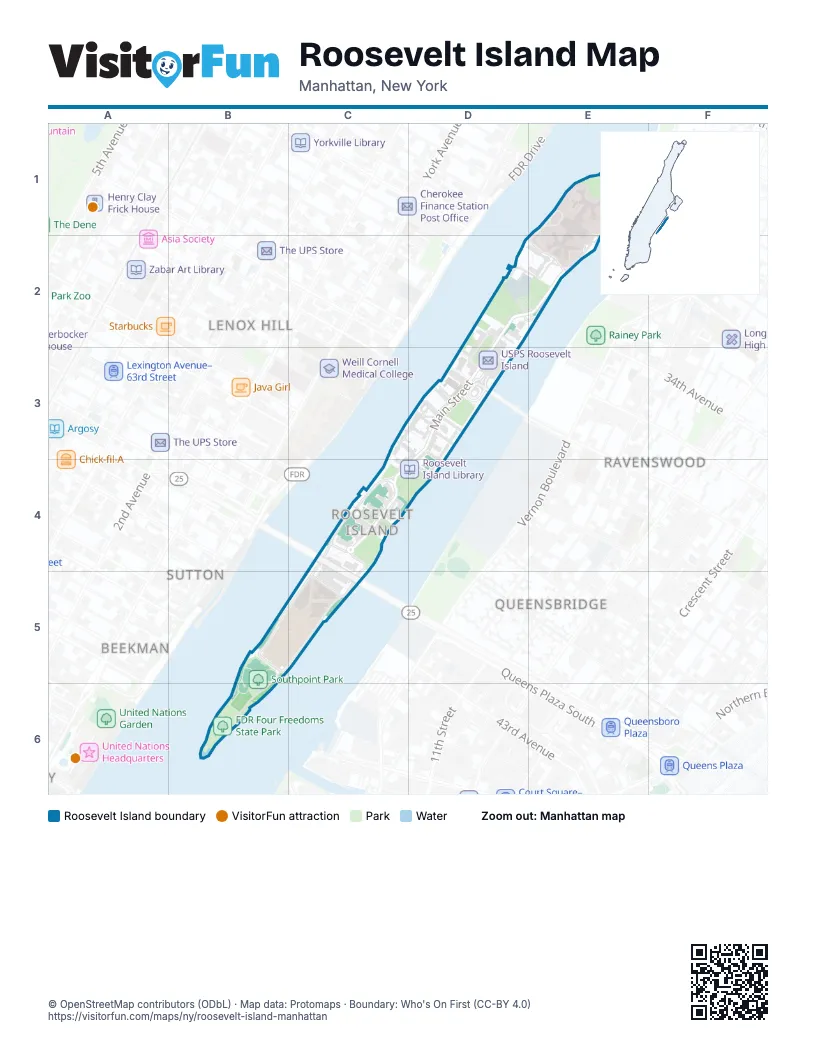
Street index of Roosevelt Island
Each street on the sheet and the grid squares it crosses.
- East RoadE1, D2, E2, B5, B6
- Roosevelt Island GreenwayE1
- West RoadE1, E2, C4
- Main StreetD2, E2, D3, C4
- River RoadD2, D3
- The OctagonE2
- Roosevelt Island BridgeD3
- East Main StreetC4, C5
- West Main StreetC4, C5
- East Loop RoadB5, C5
- South Loop RoadB5
- West Loop RoadB5, C5
- North Loop RoadC5
Places on the map
- Blackwell House
- Blackwell Park
- Campus Lawn
- Campus Plaza
- Capobianco Field
- Church of the Good Shepherd
- Dayspring Church
- Eleanor's Pier
- FDR Four Freedoms State Park
- Firefighters Field
- Foodtown
- Jack McManus Field
- Lighthouse Park
- Manhattan Park Parcel A
- NYC Health + Hospitals/Coler
- Old Church Bell
- Pony Field
- Public School 217/Intermediate School 217
- Roosevelt Island
- Roosevelt Island Garden Club
- Roosevelt Island Handball Court
- Roosevelt Island Library
- Roosevelt Island Racquet Club
- Roosevelt Island Sportspark
- Smallpox Hospital
- Southpoint Park
- The Octagon
- USPS Roosevelt Island
Next to Roosevelt Island
- Beekman
- Lenox Hill
- Queensbridge
- Ravenswood
- Sutton
- Turtle Bay
© OpenStreetMap contributors (ODbL) · Map data: Protomaps · Boundary: Who's On First (CC-BY 4.0)