

New York map
Stuyvesant Town map
A printable two-page map of Stuyvesant Town (Manhattan, New York), drawn by VisitorFun from OpenStreetMap. Page two is the street index: every street on the sheet with its grid square, the same list as below.
Open the map (PDF, US Letter)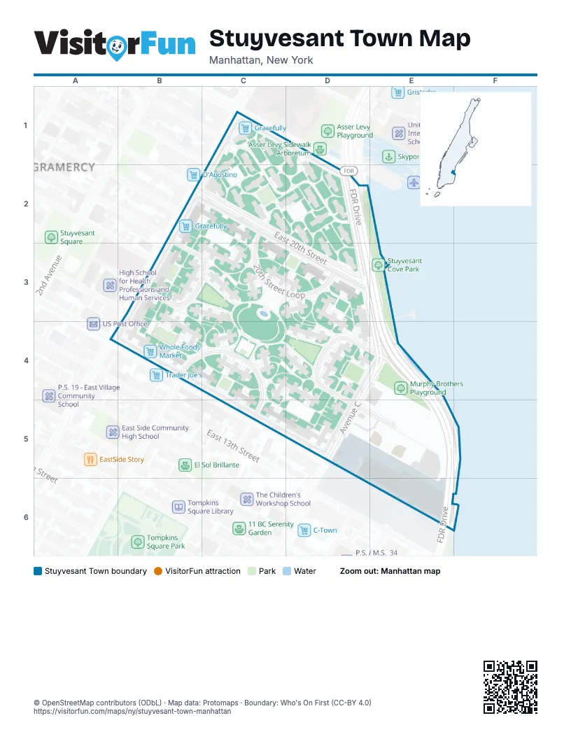
Street index of Stuyvesant Town
Each street on the sheet and the grid squares it crosses.
- East 23rd Street Access RoadC1, D1
- Peter Cooper RoadC1, D2
- 1st Avenue Service RoadB2, B3, B4
- East 20th Street Service RoadB2, D3
- First Avenue LoopB2, B3, C3
- 20th Street LoopC2, C3, D3
- East 20th StreetC2, D3
- Avenue CD2, D3, E3, E4, D5
- 14th Street LoopB4, C4, C5
- East 14th Street Service RoadB4, D5
- Avenue C LoopD4, E4, D5
- Avenue C Service RoadD4, E4, D5
- FDR DriveE4, E5, F5, E6
- East 16th StreetD5, E5
Places on the map
- ConEdison field
- Five Stuy Cafe Outdoor Seating
- Gracefully
- Murphy Brothers Playground
- Peter Cooper Village
- Stuy Town
- Stuyvesant Cove Park
- Stuyvesant Town
- Whole Foods Market
Next to Stuyvesant Town
© OpenStreetMap contributors (ODbL) · Map data: Protomaps · Boundary: Who's On First (CC-BY 4.0)