

Ohio map
Canton-Massillon Metro Area map
The sheet's index lists 17 highways; SR 43, US 62 and I-77 cross the most grid squares. Things to do inside the boundary: Belden Village Mall, Bender's Tavern and Best Western Plus North Canton Inn & Suites. Also on it: Alliance, Augusta and Beach City.
Open the map (PDF, US Letter)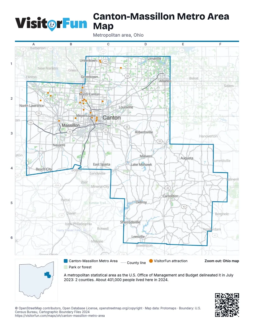
Highway index of Canton-Massillon Metro Area
Each highway on the sheet and the grid squares it crosses.
- I-77B2, B3, B4, C2, C3
- US 30A3, B3, C3, D3, E3
- US 62A3, A4, B3, C2, C3, D2, E2
- US 250A4
- SR 9E5
- SR 21A2, A4, B2, B3, B4
- SR 39C6, D5, D6, E5
- SR 43C1, C2, C3, C4, D4, E4, E5, E6, F6
- SR 44C2, C3, D1, D2
- SR 93A2, A3, A4
- SR 172A3, B3, C3
- SR 173D2, E2
- SR 183C4, D4, E3
- SR 212D5, D6
- SR 241B2, B3
- SR 619B1, C1
- SR 800C3, C4
Things to do on the Canton-Massillon Metro Area map
- Belden Village Mall
- Bender's Tavern
- Best Western Plus North Canton Inn & Suites
- Canton Classic Car Museum
- Canton Memorial Civic Center
- Canton Museum of Art
- Canton Palace Theatre
- Clay's Resort Jellystone Park
- Comfort Inn Hall of Fame
- Comfort Suites Hartville
- DoubleTree by Hilton Canton Downtown
- Embassy Suites by Hilton Akron Canton Airport
- First Ladies National Historic Site
- Gervasi Vineyard
- Gregory's Family Restaurant
- Hall of Fame Village
- Hampton Inn & Suites Canton
- Hartville Kitchen Restaurant & Bakery
- Hartville MarketPlace & Flea Market
- Hyatt Place Canton
- Maize Valley Winery & Craft Brewery
- Massillon Museum
- McKinley Presidential Library & Museum
- Pro Football Hall of Fame
- Sky Zone Belden Village
- Sluggers & Putters
- Sluggers & Putters Amusement Park
- Stark Parks
- Taggarts Ice Cream
- Wingate by Wyndham Canton/Hall of Fame
Places on the map
- Alliance
- Augusta
- Beach City
- Canton
- Carrollton
- Dellroy
- East Sparta
- Greentown
- Lake Mohawk
- Leesville
- Limaville
- Louisville
- Malvern
- Massillon
- Meyers Lake
- Navarre
- North Canton
- North Lawrence
- Robertsville
- Sherrodsville
- Uniontown
© OpenStreetMap contributors, Open Database License, openstreetmap.org/copyright · Map data: Protomaps · Boundary: U.S. Census Bureau, Cartographic Boundary Files 2024