

Ohio map
Columbus Metro Area map
The sheet's index lists 24 highways; US 33, I-71 and US 23 cross the most grid squares. Things to do inside the boundary: Hocking Hills, Ohio Stadium and Battelle Riverfront Park. Also on it: Circleville, Columbus and Delaware.
Open the map (PDF, US Letter)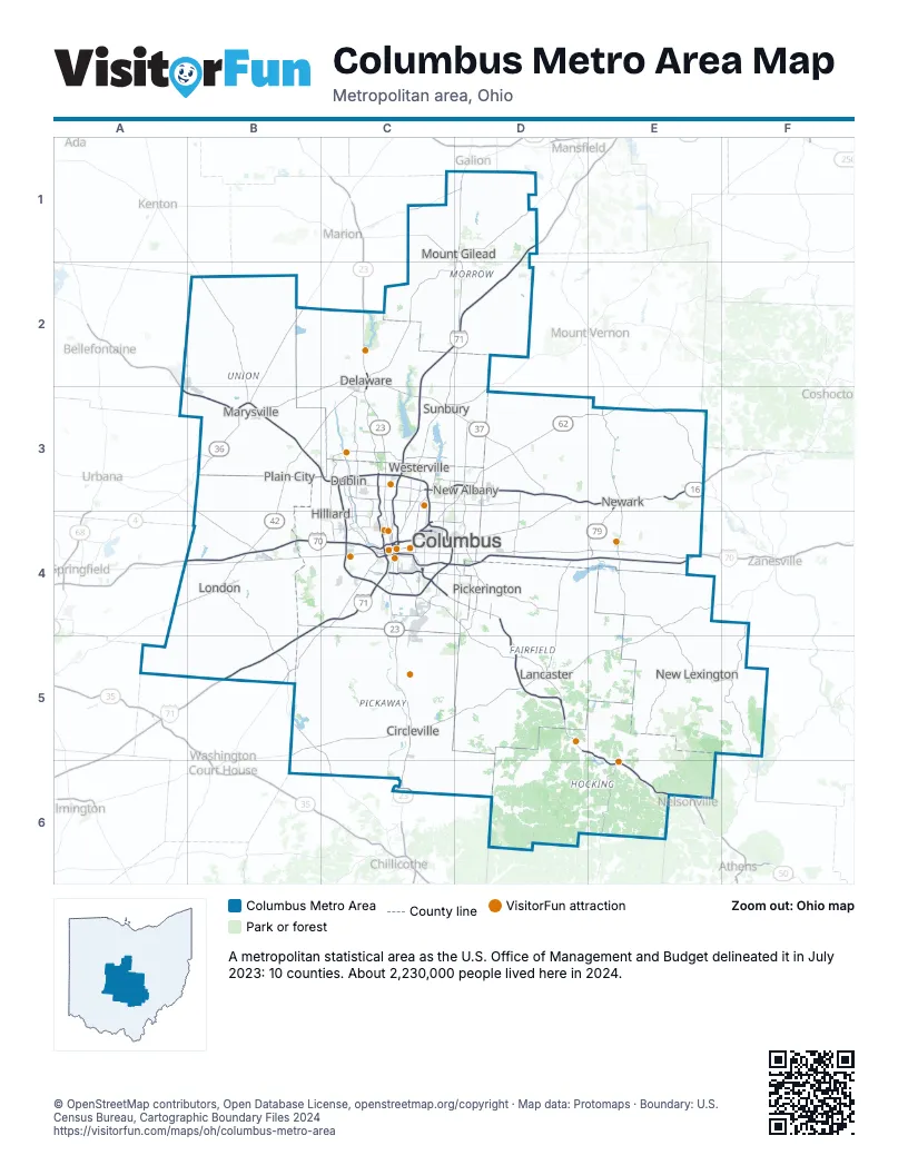
Highway index of Columbus Metro Area
Each highway on the sheet and the grid squares it crosses.
- I-70B4, C4, D4, E4
- I-71B5, C2, C3, C4, D1, D2
- I-270C3, C4
- I-670C4
- US 22D5
- US 23C2, C3, C4, C5, C6
- US 33A3, B3, C3, C4, D4, D5, E5, E6
- US 36B3, C2, C3
- US 42B3, B4, C2, C3
- US 62C3, C4, D3, E3
- SR 4B3
- SR 13E3
- SR 16C4, D3, D4, E3
- SR 37C2, C3, D3, D4, D5
- SR 79E3, E4
- SR 104C4
- SR 158D5
- SR 161B3, C3, D3
- SR 188D5
- SR 256D4
- SR 257C3
- SR 315C3, C4
- SR 316C5
- SR 521C2
Things to do on the Columbus Metro Area map
- Hocking Hills
- Ohio Stadium
- Battelle Riverfront Park
- Billy Ireland Cartoon Library & Museum
- Columbus Museum of Art
- Columbus Zoo and Aquarium
- COSI
- Dawes Arboretum
- Delaware State Park
- Early Television Museum
- Easton Town Center
- Franklin Park Conservatory and Botanical Gardens
- German Village
- Hocking Hills Canopy Tours
- Hollywood Casino Columbus
- LEGOLAND Discovery Center Columbus
- National Veterans Memorial and Museum
- Ohio Railway Museum
- Ohio's Small Town Museum
- Richard Ross Museum of Art
- Wexner Center for the Arts
Places on the map
- Circleville
- Columbus
- Delaware
- Dublin
- Hilliard
- Lancaster
- London
- Marysville
- Mount Gilead
- New Albany
- New Lexington
- Newark
- Pickerington
- Plain City
- Sunbury
- Westerville
© OpenStreetMap contributors, Open Database License, openstreetmap.org/copyright · Map data: Protomaps · Boundary: U.S. Census Bureau, Cartographic Boundary Files 2024















