

Ohio map
Delaware County map
About 237,966 people live here (Census Bureau, 2024 estimate). The sheet's index lists 92 streets; Sawmill Parkway, Columbus Pike and State Route 37 East cross the most grid squares. Things to do inside the boundary: Columbus Zoo and Aquarium.
Open the map (PDF, US Letter)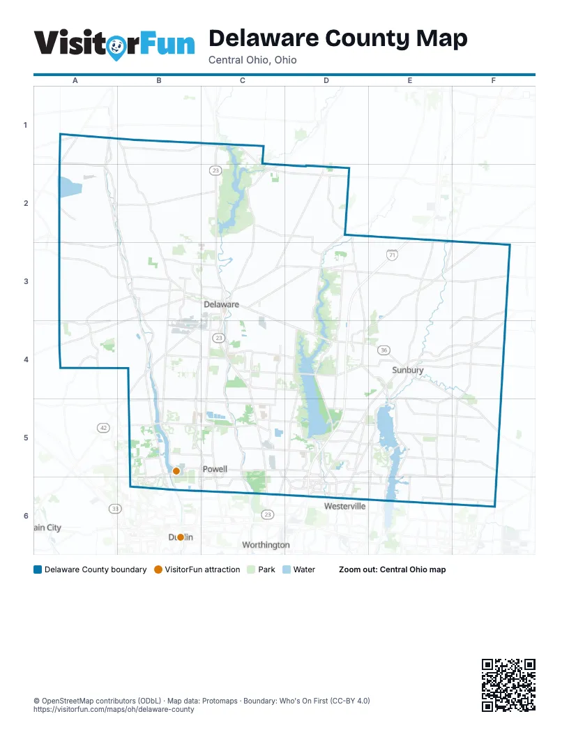
Street index of Delaware County
Each street on the sheet and the grid squares it crosses.
- Marion-Marysville RoadA1
- Prospect-Delaware RoadB1
- State Route 203B1, B2, B3
- Norton RoadC1
- Norton Waldo RoadC1
- East High StreetD2
- Marengo-NortonD2
- North Franklin StreetD2
- North Old State RoadD2, D3, D4
- South Franklin StreetD2
- West High StreetD2
- Worthington-New Haven RoadD2
- Marysville RoadB3, A4, B4
- South Section Line RoadB3, B4, B5
- SR 37B3
- State Route 37 WestB3
- West Central AvenueB3, C3
- West William StreetB3, C3
- Byxbe ParkwayC3
- Columbus PikeC3, C4, C5, C6
- East Central AvenueC3
- East William StreetC3
- Glenn RoadC3
- Kilbourne RoadC3
- Lake StreetC3
- North Sandusky StreetC3
- State Route 37 EastC3, C4, D4, E4
- Sunbury RoadC3, E5, E6
- Olive Green RoadE3, F3
- State Route 61E3, E4
- Water StreetE3
- Dublin RoadB4, B5, B6
- Riverside DriveB4, B5, B6
- Sawmill ParkwayB4, B5, C5, B6, C6
- Olentangy River RoadC4, C5, C6
- Lackey Old State RoadD4
- South Old State RoadD4, D5, C6, D6
- Cherry StreetE4
- Columbus StreetE4, E5
- Granville StreetE4
- Harrison StreetE4, E5
- Morning StreetE4
- North State StreetE4, D5, D6
- North Walnut StreetE4, E5
- South Galena RoadE4
- South Old 3C RoadE4
- US 36 & SR 3E4, F4
- Walnut StreetE4, E5
- County Road 605F4, F5
- Concord RoadB5, B6
- Glick RoadB5, B6
- Harriott RoadB5
- Home RoadB5, C5
- West Powell RoadB5, C5
- East Olentangy StreetC5
- East Powell RoadC5
- Lewis Center RoadC5, D5
- Liberty Road NorthC5
- North Liberty StreetC5
- Polaris ParkwayC5, C6, D6
- South Liberty StreetC5, C6
- West Olentangy StreetC5
- Big Walnut RoadD5, E5
- Mount Royal AvenueD5
- Olde Worthington RoadD5
- Plumb RoadD5
- South Old 3C HighwayD5, E5
- Worthington RoadD5, D6
- Tussic Street RoadE5, E6
- State Road 605F5, F6
- Avery RoadB6
- Manley RoadB6
- Muirfield DriveB6
- Flint RoadC6
- Lazelle RoadC6, D6
- Liberty RoadC6
- North High StreetC6
- Sawmill RoadC6
- County Line RoadD6
- County Line Road WestD6
- Gemini PlaceD6
- Ikea WayD6
- Lyra DriveD6
- Maxtown RoadD6, E6
- North Cleveland AvenueD6
- Orion PlaceD6
- Sancus BoulevardD6
- Fancher RoadE6, F6
- Harlem RoadE6
- North Spring RoadE6
- Smothers RoadE6
- Tussic StreetE6
Things to do on the Delaware County map
Places on the map
- Acorn Farms
- Alum Creek Beach
- Alum Creek Lake
- Alum Creek Multipurpose Trail
- Alum Creek Phase 1
- Alum Creek State Park
- Alum Creek State Park Campground
- Armenian Estates
- Arrowhead Lakes Golf Course
- Ashley
- Bayridge
- Berkshire Middle School
- Berkshire Township
- Berlin Township
- Big Meadows Picnic Area
- Big Walnut Golf Course
- Big Walnut High School
- Big Walnut Middle School
- Blues Creek Park
- Brown Township
- Buckeye Valley Local Schools
- Burr Oak Commons
- Byxbe Campus
- Cactus Hollow Preserve
- Camp Lazarus Boy Scout Reservation
- Center Green Park
- Char Mar Ridge Preserve
- Cheshire Woods
- Columbus Zoo and Aquarium
- Concord Township
- Concord Township Park
- Cottages at Hyatt
- Coyote Run Trail (3.5 mi)
- Crystal Lake
- Deer Haven Park
- Delaware
- Delaware Area Career Center
- Delaware County
- Delaware County Fair Grounds
Next to Delaware County
- Dublin
- Plain City
- Westerville
- Worthington
© OpenStreetMap contributors (ODbL) · Map data: Protomaps · Boundary: Who's On First (CC-BY 4.0)