

Ohio map
Lorain County map
About 322,030 people live here (Census Bureau, 2024 estimate). The sheet's index lists 10 streets; Ohio Turnpike, Northwest Freeway and Route 20/State Route 301 cross the most grid squares. Things to do inside the boundary: Common Ground Canopy Tour.
Open the map (PDF, US Letter)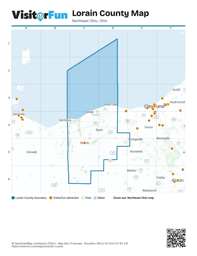
Street index of Lorain County
Each street on the sheet and the grid squares it crosses.
- Ohio TurnpikeB4, C4, D4
- Northwest FreewayC4, D4
- OH-2C4
- Ohio Turnpike ConnectorC4
- State Route 2C4
- Route 20/State Route 301D4, C5
- State Route 10D4
- Oberlin Elyria RoadC5
- Route 20C5
- State Route 301C5
Things to do on the Lorain County map
Places on the map
- Amberwood
- Amherst
- Amherst Township
- Arlington Place
- Avalon Estates
- Avon
- Avon Commons
- Avon Lake
- Avon Reserve at Summer Hill
- Bentley Park
- Black River Reservation
- Bob-O-Link Golf Course
- Briar Lakes
- Bridgeside
- Brighton Township
- Brownhelm Township
- Camden Township
- Camelot
- Carlisle Township
- Cascade Park
- Charlemont Reservation
- Columbia Reservation
- Columbia Township
- Creekwood Golf Club
- Cromwell Park
- Dorchester Meadows
- Dorlon Reservation
- Eaton Estates
- Eaton Township
- Elyria
- Elyria Country Club
- Elyria Township
- Emerald Woods
- Findley Lake
- Findley State Park
- Firelands Scout Reservation
- Forest Hills
- Four Seasons at Chestnut Ridge
- FoxCreek Golf & Racquet Club
- French Creek Reservation
Next to Lorain County
- Akron
- Brecksville
- Brunswick
- Cleveland map
- Cleveland Heights
- Copley
- Euclid
- Lakewood
- Medina
- North Royalton
- Norwalk
- Parma
- Rocky River
- Sandusky
- Shaker Heights
- South Euclid
- Strongsville
- Vermilion
- Wadsworth
© OpenStreetMap contributors (ODbL) · Map data: Protomaps · Boundary: Who's On First (CC-BY 4.0)