

Ohio map
Muskingum County map
About 86,582 people live here (Census Bureau, 2024 estimate). The sheet's index lists 70 streets; Friendship Drive, Newark Road and East Pike cross the most grid squares. Things to do inside the boundary: Dresden.
Open the map (PDF, US Letter)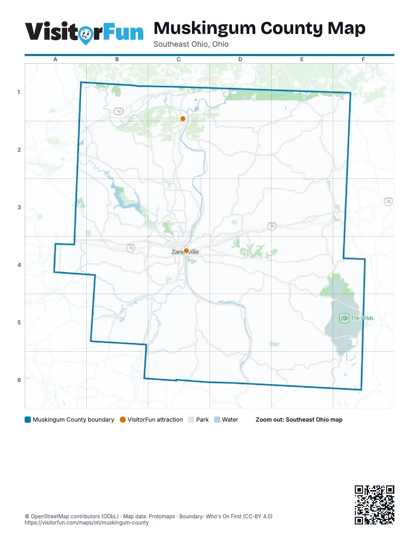
Street index of Muskingum County
Each street on the sheet and the grid squares it crosses.
- Blackrun RoadA1, A2, B2
- Dresden Adamsville RoadC1, D1, D2
- East Muskingum AvenueC1
- Frazeysburg RoadC1, C2, C3
- Main StreetC1, C4, D5
- North River Road EastC1, C2, C3
- Raiders RoadC1, D1
- West 9th StreetC1
- Adamsville Otsego RoadE1, D2, E2
- Coshocton RoadE1
- Friendship DriveE1, E2, F2, E3, F3
- Plainfield RoadE1, F1
- Boden RoadF1
- Newark ExpresswayA2
- Newark RoadA2, B2, B3, C3, C4
- Northpointe DriveC2, C3
- Adamsville RoadD2, D3
- Cambridge RoadD2, F2
- East StreetD2
- Lewis DriveC3, C4
- Maple AvenueC3, C4
- East PikeD3, E3, F3, C4, D4
- Pleasant Grove RoadD3, D4
- East Main StreetF3
- John Glenn HighwayF3
- North Friendship DriveF3
- South Friendship DriveF3
- West Main StreetF3, C4
- West RoadF3
- National Road SoutheastA4
- West PikeA4, B4, C4
- 9th StreetC4
- Adair AvenueC4
- Blue AvenueC4
- Canal StreetC4
- Chandlersville RoadC4, D4, E4, E5, F5
- Elberon AvenueC4
- Elm StreetC4
- Greenwood AvenueC4
- Hall AvenueC4
- Jackson StreetC4
- Linden AvenueC4
- Marietta StreetC4
- Market StreetC4
- Maysville AvenueC4
- Maysville PikeC4, B5, C5
- North 5th StreetC4
- North 6th StreetC4
- North 7th StreetC4
- North Maysville AvenueC4
- Old River RoadC4, C5
- Pine StreetC4
- Putnam AvenueC4
- Sharon AvenueC4
- South 5th StreetC4
- South 6th StreetC4
- South 7th StreetC4
- South Maysville AvenueC4
- South River RoadC4, C5, D5, D6
- State StreetC4
- Underwood StreetC4
- Wayne AvenueC4
- Zane StreetC4
- Big Muskie DriveE4, E5, F5, E6, F6
- Claysville RoadE4, F4
- Roseville RoadB5, C5
- Saltillo RoadB5
- Center RoadC5, C6
- Cumberland RoadF5, F6
- Rockville RoadD6, E6
Things to do on the Muskingum County map
Places on the map
- Adams Mills
- Adams Township
- Adamsville
- Airport Business Park
- Armco Ball Diamonds Park
- Bakers Pond
- Blue Rock State Park
- Blue Rock Township
- Boyd Gravel Pit
- Brush Creek Township
- Cass Township
- Catholic Schools of Zanesville
- Chateau Estates
- Clay Township
- Colonial Place
- Colony Square Mall
- Country Fair Shopping Center
- Crystal Springs
- Cutler Lake
- Diehr Lake
- Dillion State Park
- Dillon Lake
- Dillon State Wildlife Area
- Dresden
- Dresden Energy Facility
- Duncan Falls Cemetery
- EagleSticks
- East Central Ohio Business Park
- East Muskingum Local Schools
- Eastpointe Business Park
- Falls Township
- Franklin Local School District
- Frazeysburg
- Fuller's Fairways
- Fultonham
- Fultonham Cemetery
- Fultonham Plant #1
- Genesis Healthcare System
- Greenwood Cemetery
- Harrison Township
© OpenStreetMap contributors (ODbL) · Map data: Protomaps · Boundary: Who's On First (CC-BY 4.0)