

Ohio map
Southeast Ohio map
The sheet's index lists 29 highways; SR 124, SR 32 and I-77 cross the most grid squares. Things to do inside the boundary: Coshocton Hot Air Balloon Festival, Hocking Hills and Hocking Hills Canopy Tours. Also on it: Athens, Bellaire and Caldwell.
Open the map (PDF, US Letter)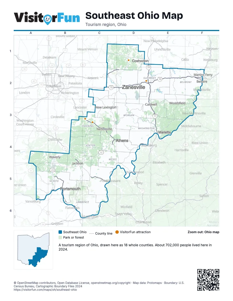
Highway index of Southeast Ohio
Each highway on the sheet and the grid squares it crosses.
- I-70C2, D2, E2, F2
- I-77D1, D2, D3, E3, E4
- I-470F2
- US 22D2, E2
- US 23B4, B5
- US 33C3, C4, D4, D5
- US 35B4, B5, C5
- US 36D1
- US 40E2
- US 50C4, D4
- US 52A5, A6, B5, B6, C6
- WV 2F2
- SR 7C5, D4, D5, E4, F2
- KY 8B5
- KY 10B6
- SR 16C2, D1, D2
- SR 32A4, A5, B4, B5, C4, D4
- SR 60E4
- SR 83D1
- SR 104B4
- SR 124A4, A5, B4, B5, C4, C5, D5
- SR 253B6
- SR 335B4
- SR 735C5
- SR 772A4, A5
- SR 800E2
- SR 823B5
- SR 852B5
- SR 872F2
Things to do on the Southeast Ohio map
Places on the map
- Athens
- Bellaire
- Caldwell
- Coshocton
- Jackson
- Marietta
- Martins Ferry
- Nelsonville
- New Lexington
- Portsmouth
- Waverly
- Woodsfield
- Zanesville
Next to Southeast Ohio
- Eastern Highlands-North
- Northern Kentucky
- Central Ohio map
- Northeast Ohio map
- Southwest Ohio map
- Hatfield-McCoy Mountains
- Metro Valley
- Mid-Ohio Valley
- Northern Panhandle
© OpenStreetMap contributors, Open Database License, openstreetmap.org/copyright · Map data: Protomaps · Boundary: U.S. Census Bureau, Cartographic Boundary Files 2024