

Oregon road map
Oregon highway map
6 Interstate routes run about 699 miles in Oregon, each on a sheet of its own. The sheet's index lists 18 highways; I-84, US 30 and I-5 cross the most grid squares. Towns on it: Portland, Salem and Eugene.
Open the map (PDF, US Letter)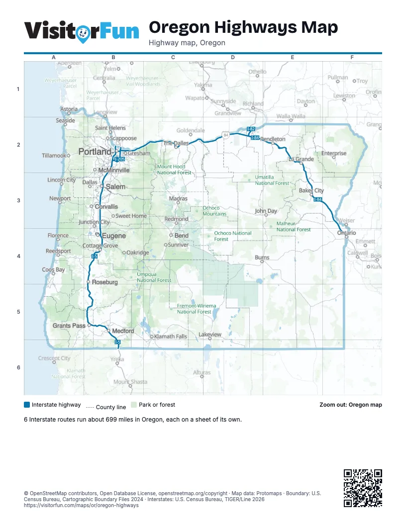
Road maps of Oregon
5 road maps: each Interstate and byway on a sheet of its own.
Highway index of Oregon
Each highway on the sheet and the grid squares it crosses.
- I-5B2, B3, B4, B5, B6
- I-82D2
- I-84B2, C2, D2, E2, E3, F3, F4
- I-105B4
- I-205B2
- I-405B2
- US 26B2
- US 30B2, C2, D2, E2, E3, F3, F4
- US 395D2, E2
- OR 22B3
- OR 99B4, B5
- OR 99EB3
- OR 126B4
- OR 132B4
- OR 138B4
- OR 213B2
- OR 217B2
- OR 569B4
Places on the map
- Astoria
- Baker City
- Bend
- Burns
- Coos Bay
- Corvallis
- Cottage Grove
- Dallas
- Enterprise
- Eugene
- Florence
- Grants Pass
- Gresham
- John Day
- Junction City
- Klamath Falls
- La Grande
- Lakeview
- Lincoln City
- Madras
- McMinnville
- Medford
- Newport
- Oakridge
- Ontario
- Pendleton
- Portland
- Redmond
- Reedsport
- Roseburg
- Saint Helens
- Salem
- Scappoose
- Seaside
- Sunriver
- Sweet Home
- The Dalles
- Tillamook
© OpenStreetMap contributors, Open Database License, openstreetmap.org/copyright · Map data: Protomaps · Boundary: U.S. Census Bureau, Cartographic Boundary Files 2024 · Interstates: U.S. Census Bureau, TIGER/Line 2026