

Pennsylvania map
Adams County map
About 107,914 people live here (Census Bureau, 2024 estimate). The sheet's index lists 62 streets; Carlisle Pike, Baltimore Pike and Main Street cross the most grid squares. Things to do inside the boundary: Civil War Tails at the Homestead Diorama Museum, Gettysburg National Military Park and The Outlet Shoppes at Gettysburg.
Open the map (PDF, US Letter)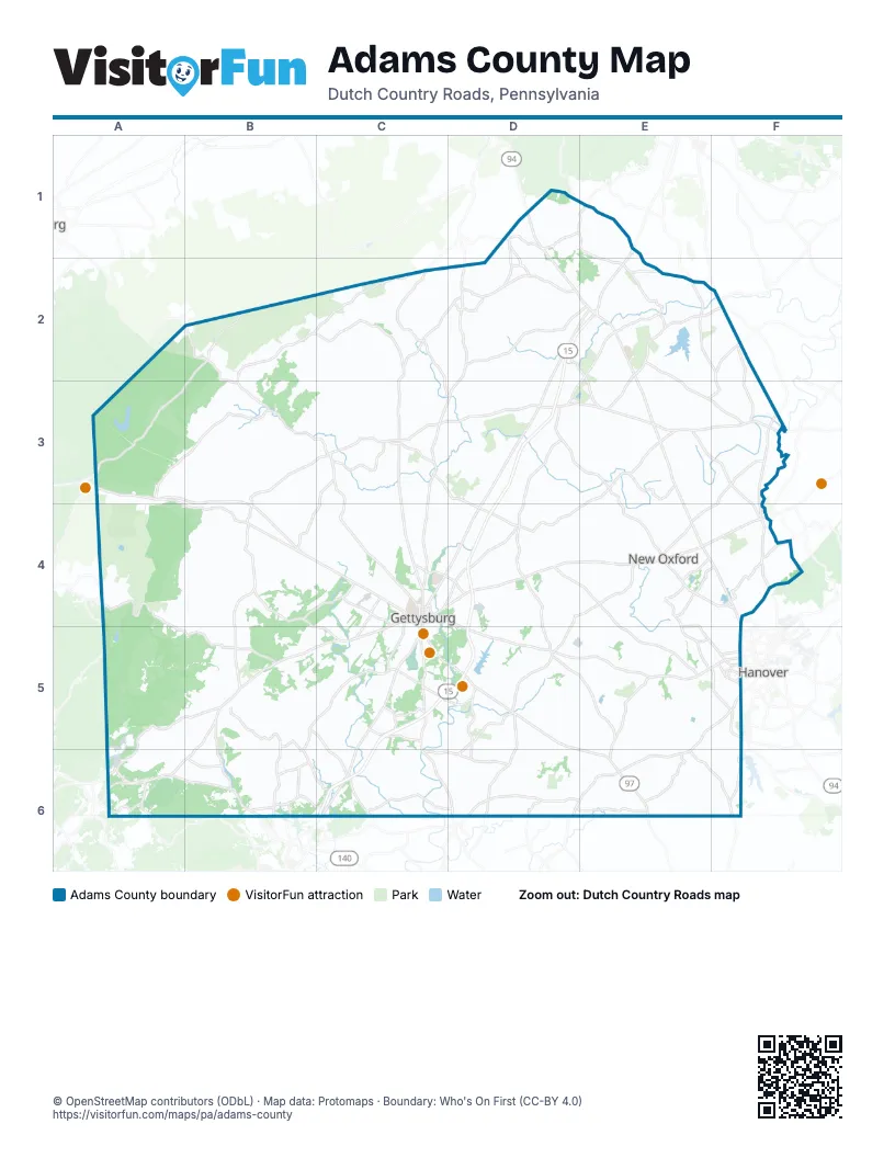
Maps inside Adams County
1 map inside, from the street map of Adams County down.
Street index of Adams County
Each street on the sheet and the grid squares it crosses.
- Baltimore PikeD1, F3, C5, D5, E6
- Carlisle PikeD1, D2, E2, E3, E4, F4
- Pine Grove RoadB2, A3, B3
- Carlisle RoadC2, D2, C3
- Main StreetD2, E2, C3, E5, F5
- Buchanan Valley RoadA3, B3
- Chambersburg RoadA3, B3, B4, C4
- Narrows RoadB3, C3
- Arendtsville RoadC3
- Biglerville RoadC3, C4
- East Hanover StreetC3, D5
- East York StreetC3
- Heidlersburg RoadC3, D3
- North High StreetC3
- North Main StreetC3
- Shrivers Corner RoadC3, D3, D4
- South Main StreetC3
- Table Rock RoadC3
- West Hanover StreetC3, D5
- West York StreetC3
- East Berlin RoadD3, E3, F3
- Hunterstown Hampton RoadE3, D4, E4
- Abbottstown StreetF3
- East King StreetF3, F4, E6
- Harrisburg StreetF3, C4
- West King StreetF3, F4, E6
- Baltimore StreetC4, C5
- Buford AvenueC4
- Carlisle StreetC4, F4
- Chambersburg StreetC4
- East Lincoln AvenueC4
- Fairfield RoadC4, B5, C5, B6
- Hanover RoadC4, D4, D5, E5
- Hanover StreetC4, E4, F4
- Lincoln SquareC4
- Old Harrisburg RoadC4, D4
- West Middle StreetC4
- York RoadC4, D4, E4, F4
- York StreetC4
- Center SquareE4
- Lincoln Way EastE4
- Lincoln Way WestE4
- Abbottstown PikeF4
- North Queen StreetF4, E6
- South Queen StreetF4, E6
- East Main StreetB5
- Jacks Mountain RoadB5, A6, B6
- West Main StreetB5
- Emmitsburg RoadC5, C6
- South Washington StreetC5
- Steinwehr AvenueC5
- Taneytown RoadC5, C6, D6
- Hanover PikeE5, F5, E6
- 3rd StreetF5
- West Elm AvenueF5
- Buchanan Trail EastA6
- Waynesboro PikeA6, B6
- Catoctin Mountain HighwayC6
- Old Gettysburg RoadC6
- Frederick PikeD6, E6
- Littlestown PikeE6
- Old Westminster RoadF6
Things to do on the Adams County map
Places on the map
- Abbottstown
- Adams County
- Allwood Manor
- Arendtsville
- Aspers
- Barley Circle
- Battlefield Land Acquisition Grant Tract
- Beaver Creek Villiage
- Bendersville
- Berwick Township
- Biesecker Woods
- Biglerville
- Bliss Farm
- Bonneau Heights
- Bonneauville
- Bridges Golf Club
- Bushman Farm
- Butler Township
- Camp Nawakwa
- Carbaugh Reservoir
- Carbaugh Run Natural Area
- Carroll Valley
- Carroll Valley Golf Resort
- Cashtown-McKnightstown
- Cavalry Field Mobile Home Park
- Cedar Ridge
- Cedar Ridge Golf Course
- Cemetery Hill
- Chapel Ridge
- Chapel View
- Colonial Ridge Townhomes
- Conewago Township
- Crosswinds
- Culps Hill
- Cumberland Township
- Daniel Lady Farm
- Drummer Boy Camping Resort
- Eagle View Mobile Home Park
- East Berlin
- Edgegrove
Next to Adams County
- Hanover
© OpenStreetMap contributors (ODbL) · Map data: Protomaps · Boundary: Who's On First (CC-BY 4.0)