

Pennsylvania map
Chester County map
About 560,745 people live here (Census Bureau, 2024 estimate). The sheet's index lists 10 streets; Pennsylvania Turnpike, Coatesville-Downingtown Bypass and Kennett-Oxford Bypass cross the most grid squares. Things to do inside the boundary: Herr's Snack Factory Tour, Longwood Gardens and Montgomery County.
Open the map (PDF, US Letter)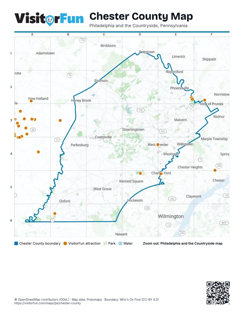
Street index of Chester County
Each street on the sheet and the grid squares it crosses.
- Pottstown BypassD1
- Pottstown ExpresswayD1
- Pottstown PikeD1
- Pennsylvania TurnpikeC2, D2, D3, E3, F3
- County Line ExpresswayF2, F3
- Coatesville-Downingtown BypassB3, C3, D3, B4
- Exton BypassD3, E3
- West Chester BypassE4
- Kennett-Oxford BypassB5, C5, D5, B6
- East Baltimore PikeD5
Things to do on the Chester County map
Places on the map
- Anfield at Malvern
- Anson B. Nixon Park
- Applebrook Golf Club
- Ashbridge Preserve
- Atglen
- Avondale
- Balmoral
- Bellewood Country Club
- Big Elk Creek State Park
- Binky Lee Preserve
- Birmingham Hill Preserve
- Black Rock Pool
- Black Rock Sanctuary
- Blue Rock Farm
- Bondsville Mill Park
- Bow Tree
- Bradford Square
- Brandywine at Thornbury
- Brandywine Battlefield
- Brandywine Knoll
- Brandywine Meadows Preserve
- Brandywine Square
- Brightside Farm
- Broad Run Golfer's Club
- Bryn Coed Preserve
- Caln Township
- Camp Saginaw
- Catanach Quarry
- Cedar Hollow Park
- Cedar Hollow Preserve
- Chambers Lake
- Charlestown Hunt
- Charlestown Meadows
- Charlestown Township
- ChesLen Preserve
- Chester County
- Chester County G. O. Carlson Airport
- Chester Valley Golf Club
- Chesterbrook
- Chrome Serpentine Barrens
Next to Chester County
- Adamstown
- Birdsboro
- Brookhaven
- Chadds Ford
- Chester
- Chester Heights
- Claymont
- Ephrata
- Hockessin
- King of Prussia
- Limerick
- Marple Township
- Media
- New Holland
- Newark
- Norristown
- Pottstown
- Radnor
- Royersford
- Skippack
- Springfield
- Trappe
- Upper Providence
- Wayne
- Wilmington
© OpenStreetMap contributors (ODbL) · Map data: Protomaps · Boundary: Who's On First (CC-BY 4.0)