

Pennsylvania map
Harrisburg-Carlisle Metro Area map
The sheet's index lists 14 highways; I-81, I-76 and US 322 cross the most grid squares. Things to do inside the boundary: AACA Museum, Antique Marketplace of Lemoyne and Bass Pro Shops. Also on it: Carlisle, Harrisburg and Hershey.
Open the map (PDF, US Letter)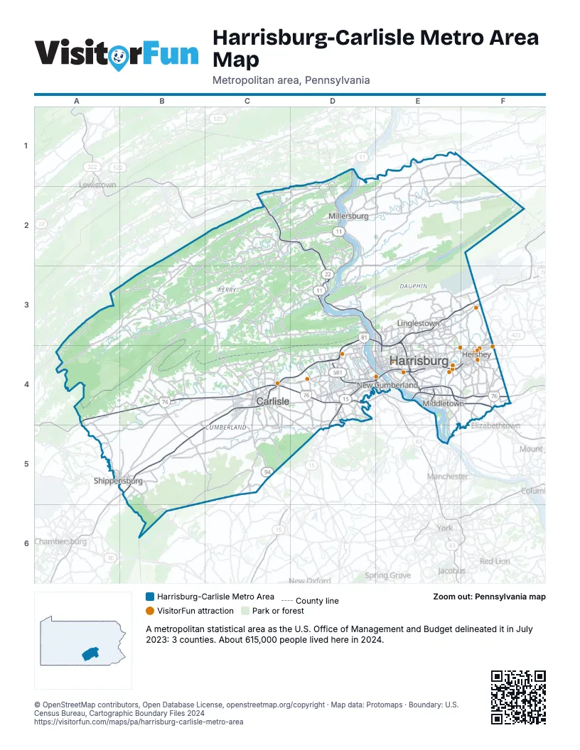
Highway index of Harrisburg-Carlisle Metro Area
Each highway on the sheet and the grid squares it crosses.
- I-76A4, B4, C4, D4, E4, F4
- I-81B5, C4, C5, D3, D4, E3, E4, F3
- I-83E3, E4
- I-283E4
- US 11C4, D1, D2, D3, D4
- US 15D1, D2, D3, D4, D5
- US 22C2, D2, D3, E3, E4
- US 322C2, D2, D3, E3, E4, F4
- US 422F4
- PA 34C4, C5
- PA 94C5
- PA 230E4
- PA 283E4, F4
- PA 581D4, E4
Things to do on the Harrisburg-Carlisle Metro Area map
- AACA Museum
- Antique Marketplace of Lemoyne
- Bass Pro Shops
- Best Western Plus Hershey
- Carlisle Sports Emporium
- Challenge Family Fun Center
- Crossroads Antique Mall
- Cumberland Valley
- Hershey's Chocolate World
- Hersheypark
- Holiday Inn Express & Suites Harrisburg West - Mechanicsburg
- Indian Echo Caverns
- MainStay Suites Grantville - Hershey North
- Middletown & Hummelstown Railroad
- National Civil War Museum
- Playa Bowls Hershey
- The Hershey Story
- Toys on the Square
- Troegs Independent Brewing
- Where The Wild Things Play
- Yokl Tours
Places on the map
- Carlisle
- Harrisburg
- Hershey
- Linglestown
- Middletown
- Millersburg
- New Cumberland
- Shippensburg
© OpenStreetMap contributors, Open Database License, openstreetmap.org/copyright · Map data: Protomaps · Boundary: U.S. Census Bureau, Cartographic Boundary Files 2024