

South Carolina road map
Savannah River Scenic Byway map
The Savannah River Scenic Byway has been a National Scenic Byway since 1998, named for its historic qualities: about 108 miles in South Carolina. It meets 18 highways, among them I-85, US 29 and US 221. Towns along it: McCormick, Calhoun Falls and Iva.
Open the map (PDF, US Letter)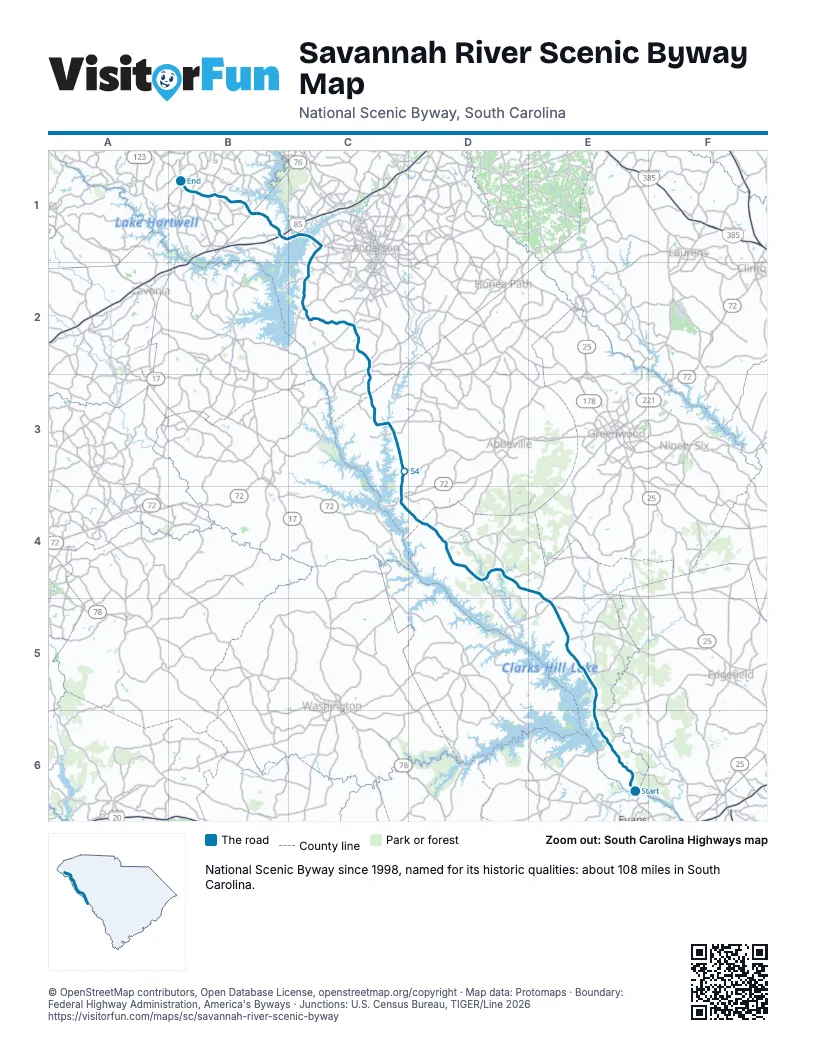
Highways it meets
Each highway it meets and the grid squares where they meet.
- SC 28E6
- US 221E6
- SC 23E5
- SC 283E5
- US 378E5
- SC 10E4
- SC 81D4
- SC 72C4
- SC 284C3
- SC 184C2
- SC 413C2
- SC 181C2
- SC 412C2
- US 29C2
- SC 24C1
- I-85B1
- SC 59B1
- SC 182B1
Towns along the Savannah River Scenic Byway
In mile order, with the grid square of each.
- Clarks Hillmile 4, E6
- Modocmile 9, E6
- Parksvillemile 16, E5
- Plum Branchmile 21, E5
- McCormickmile 25, E5
- Willingtonmile 36, D4
- Mount Carmelmile 42, D4
- Calhoun Fallsmile 50, C4
- Lowndesvillemile 61, C3
- Ivamile 68, C2
- Starrmile 74, C2
© OpenStreetMap contributors, Open Database License, openstreetmap.org/copyright · Map data: Protomaps · Boundary: Federal Highway Administration, America's Byways · Junctions: U.S. Census Bureau, TIGER/Line 2026