

South Carolina map
Thoroughbred Country map
The sheet's index lists 16 highways; US 301, I-20 and US 321 cross the most grid squares. Things to do inside the boundary: Rivers Bridge State Park. Also on it: Aiken, Allendale and Barnwell.
Open the map (PDF, US Letter)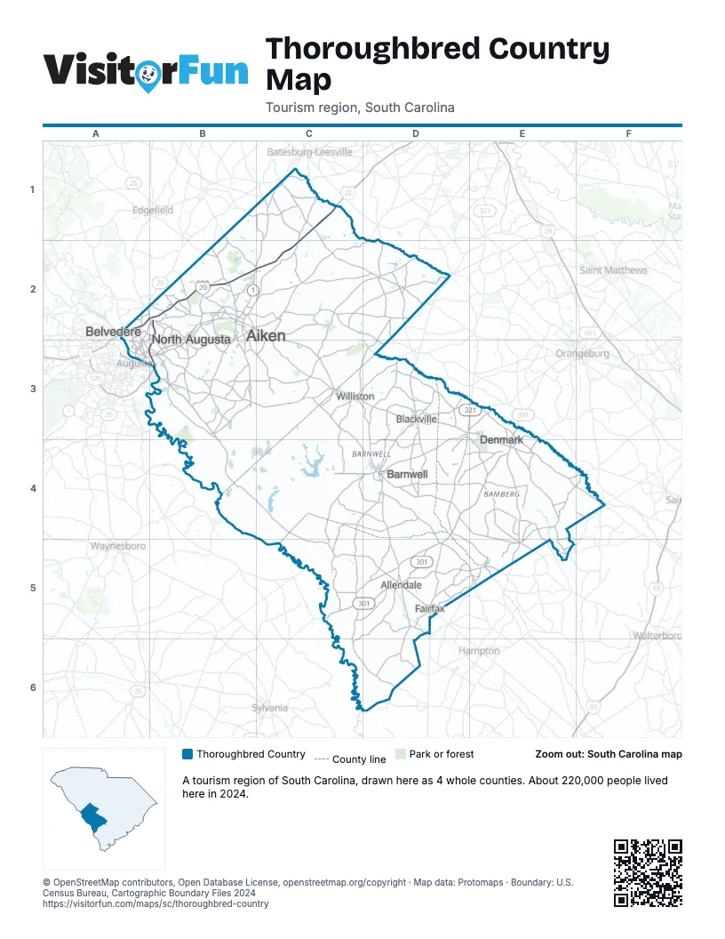
Highway index of Thoroughbred Country
Each highway on the sheet and the grid squares it crosses.
- I-20A2, B2, C1, C2
- I-520A3, B2, B3
- US 1A3, B2, B3
- US 25A2, A3, B2
- US 78A3, B2, B3
- US 278A3, B3, D5
- US 301C5, D4, D5, E3, E4
- US 321D3, D4, D5, E3
- US 601E3, E4
- GA 10A3
- SC 19B2
- SC 64D4
- SC 70D3
- SC 118B2
- GA 121A3
- SC 121A2, A3, B2
Things to do on the Thoroughbred Country map
Places on the map
- Aiken
- Allendale
- Barnwell
- Belvedere
- Blackville
- Denmark
- Fairfax
- North Augusta
- Williston
Next to Thoroughbred Country
- Classic South
- Magnolia Midlands
- Capital City & Lake Murray Country map
- Lowcountry & Resort Islands
- Santee Cooper Country map
- The Old 96 District map
© OpenStreetMap contributors, Open Database License, openstreetmap.org/copyright · Map data: Protomaps · Boundary: U.S. Census Bureau, Cartographic Boundary Files 2024