

South Carolina map
South Carolina map
Things to do inside the boundary: Alligator Adventure, Angel Oak and Arthur Ravenel Jr. Bridge. Also on it: Cape Romain National Wildlife Refuge, Carolina Sandhills National Wildlife Refuge and Cheraw State Park. Just past the edge: Asheville, Athens and Augusta.
Open the map (PDF, US Letter)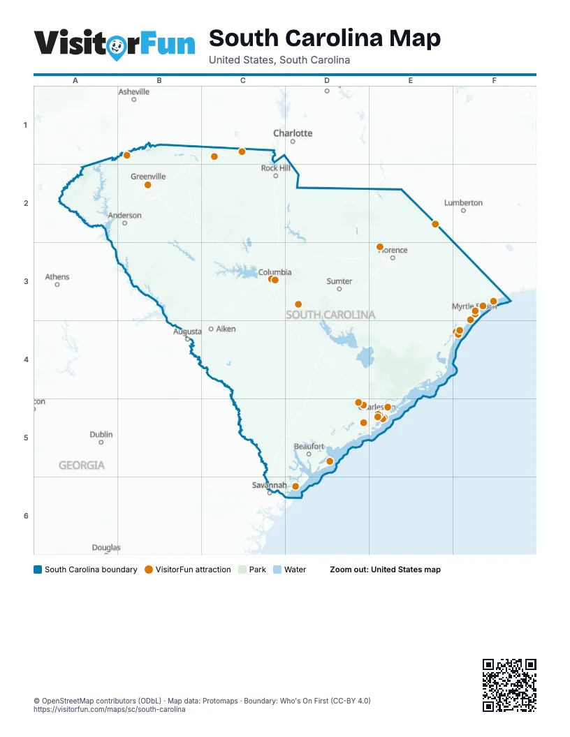
Maps inside South Carolina
9 maps inside, from the street map of South Carolina down.
Things to do on the South Carolina map
- Alligator Adventure
- Angel Oak
- Arthur Ravenel Jr. Bridge
- Barefoot Landing
- Boone Hall Plantation & Gardens
- Broadway at the Beach
- Brookgreen Gardens
- Caesars Head State Park
- Charleston City Market
- Congaree National Park
- Darlington Raceway
- Drayton Hall
- Falls Park on the Reedy
- Family Kingdom Amusement Park
- Fort Moultrie
- Fort Sumter
- Harbour Town Lighthouse
- Hunting Island State Park
- Huntington Beach State Park
- International African American Museum
- Kings Mountain National Military Park
- Magnolia Plantation and Gardens
- Middleton Place
- Mount Atlanticus Minotaur Golf
- Murrells Inlet MarshWalk
- Myrtle Beach Boardwalk and Promenade
- Myrtle Beach State Park
- Myrtle Beach, SC
- Patriots Point Naval & Maritime Museum
- Peachoid
- Pirates Voyage Dinner & Show
- Rainbow Row
- Ripley's Aquarium of Myrtle Beach
- Riverbanks Zoo & Garden
- Sea Captain's House
- SkyWheel Myrtle Beach
- South Carolina Aquarium
- South Carolina State House
- South of the Border
- The Battery
- WonderWorks Myrtle Beach
Places on the map
- Cape Romain National Wildlife Refuge
- Carolina Sandhills National Wildlife Refuge
- Cheraw State Park
- Congaree National Park
- Croft State Park
- Florence-Darlington Technical College
- Fort Jackson
- Francis Marion National Forest
- Jocassee Gorges
- Joint Base Lindsey Graham
- Jones Gap State Park
- Kings Mountain State Park
- Manchester State Forest
- Poinsett Bombing Range
- Sage Valley Golf Club
- Sand Hills State Forest
- Sandhills State Forest
- Santee National Wildlife Refuge
- Savannah River Site
- Sumter National Forest
- Wambaw Creek Wilderness
- Wambaw Swamp Wilderness
Next to South Carolina
- Asheville
- Athens
- Augusta
- Charlotte
- Dublin
- Lumberton
- Salisbury
- Savannah
© OpenStreetMap contributors (ODbL) · Map data: Protomaps · Boundary: Who's On First (CC-BY 4.0)