

South Dakota map
Glacial Lakes & Prairies map
The sheet's index lists 11 highways; I-29, US 12 and US 14 cross the most grid squares. Things to do inside the boundary: Bramble Park Zoo, Brookings County Museum and Children's Museum of South Dakota. Also on it: Aberdeen, Agency Village and Britton.
Open the map (PDF, US Letter)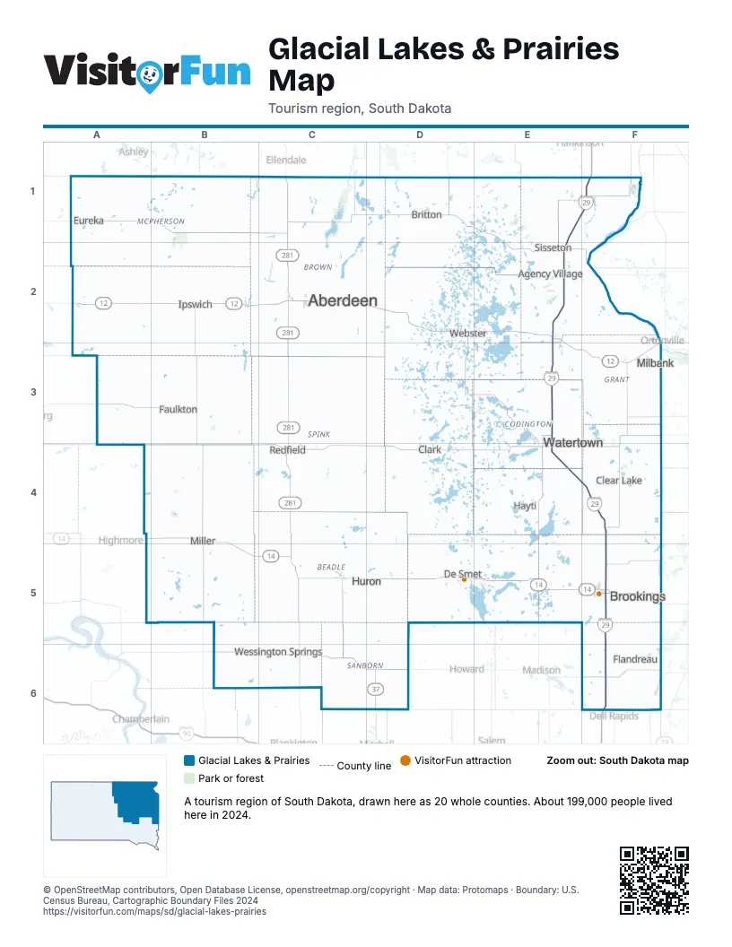
Highway index of Glacial Lakes & Prairies
Each highway on the sheet and the grid squares it crosses.
- I-29E1, E2, E3, E4, F1, F4, F5, F6
- US 12A2, B2, C2, D2, E2, E3, F3
- US 14A4, B4, B5, C5, D5, E5, F5
- US 81E1, E2, E3, E5, F1
- US 212C4
- US 281C1, C2, C3, C4, C5
- SD 10C1
- SD 34C6, D6
- SD 37C5, C6, D6
- SD 45B2, B4
- SD 47A2
Things to do on the Glacial Lakes & Prairies map
Places on the map
- Aberdeen
- Agency Village
- Britton
- Brookings
- Clark
- Clear Lake
- De Smet
- Eureka
- Faulkton
- Flandreau
- Hayti
- Huron
- Ipswich
- Milbank
- Miller
- Redfield
- Sisseton
- Watertown
- Webster
- Wessington Springs
Next to Glacial Lakes & Prairies
- Southern Minnesota
- South Central North Dakota
- Southeast North Dakota
- Missouri River map
- Southeast South Dakota map
© OpenStreetMap contributors, Open Database License, openstreetmap.org/copyright · Map data: Protomaps · Boundary: U.S. Census Bureau, Cartographic Boundary Files 2024