

South Dakota road map
South Dakota highway map
4 Interstate routes run about 670 miles in South Dakota, each on a sheet of its own. The sheet's index lists 17 highways; I-90, I-29 and US 14 cross the most grid squares. Towns on it: Sioux Falls, Rapid City and Aberdeen.
Open the map (PDF, US Letter)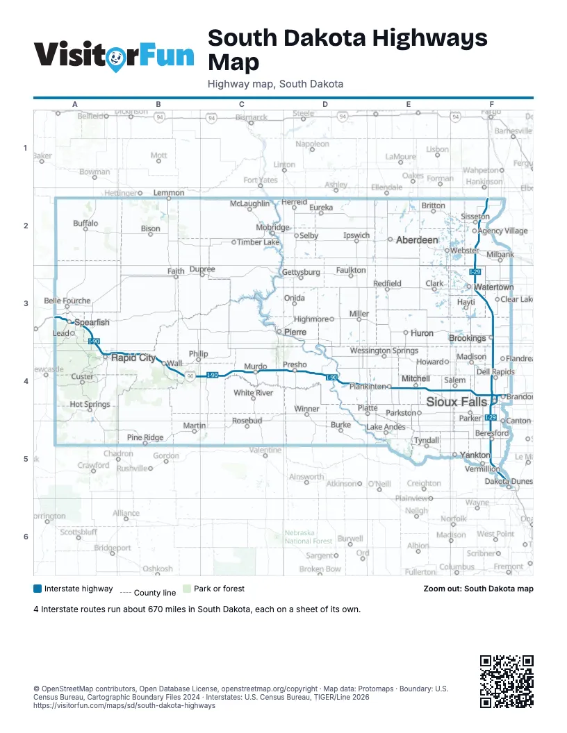
Road maps of South Dakota
3 road maps: each Interstate and byway on a sheet of its own.
Highway index of South Dakota
Each highway on the sheet and the grid squares it crosses.
- I-29F2, F3, F4, F5
- I-90A3, A4, B4, C4, D4, E4, F4
- I-190A4
- I-229F4
- US 14A3, A4, B4
- US 16A4
- US 18F5
- US 81F2, F3
- US 83C4
- US 85A3
- SD 34A3
- SD 37E4
- SD 45D4, E4
- SD 50D4
- SD 63C4
- SD 73B4, C4
- SD 79A3, A4
Places on the map
- Aberdeen
- Agency Village
- Belle Fourche
- Beresford
- Bison
- Brandon
- Britton
- Brookings
- Buffalo
- Burke
- Canton
- Clark
- Clear Lake
- Custer
- Dakota Dunes
- Dell Rapids
- Dupree
- Eureka
- Faith
- Faulkton
- Flandreau
- Gettysburg
- Hayti
- Herreid
- Highmore
- Hot Springs
- Howard
- Huron
- Ipswich
- Lake Andes
- Lead
- Lemmon
- Madison
- Martin
- McLaughlin
- Milbank
- Miller
- Mitchell
- Mobridge
- Murdo
- Onida
- Parker
- Parkston
- Philip
- Pierre
- Pine Ridge
- Plankinton
- Platte
- Presho
- Rapid City
- Redfield
- Rosebud
- Salem
- Selby
- Sioux Falls
- Sisseton
- Spearfish
- Timber Lake
- Tyndall
- Vermillion
- Wall
- Watertown
- Webster
- Wessington Springs
- White River
- Winner
- Yankton
© OpenStreetMap contributors, Open Database License, openstreetmap.org/copyright · Map data: Protomaps · Boundary: U.S. Census Bureau, Cartographic Boundary Files 2024 · Interstates: U.S. Census Bureau, TIGER/Line 2026