

Tennessee map
Montgomery County map
About 246,025 people live here (Census Bureau, 2024 estimate). The sheet's index lists 82 streets; Dover Road, State Highway 13 and Peachers Mill Road cross the most grid squares. Also on it: Airport, Amazon BNA6 and American Snuff Company, LLC.
Open the map (PDF, US Letter)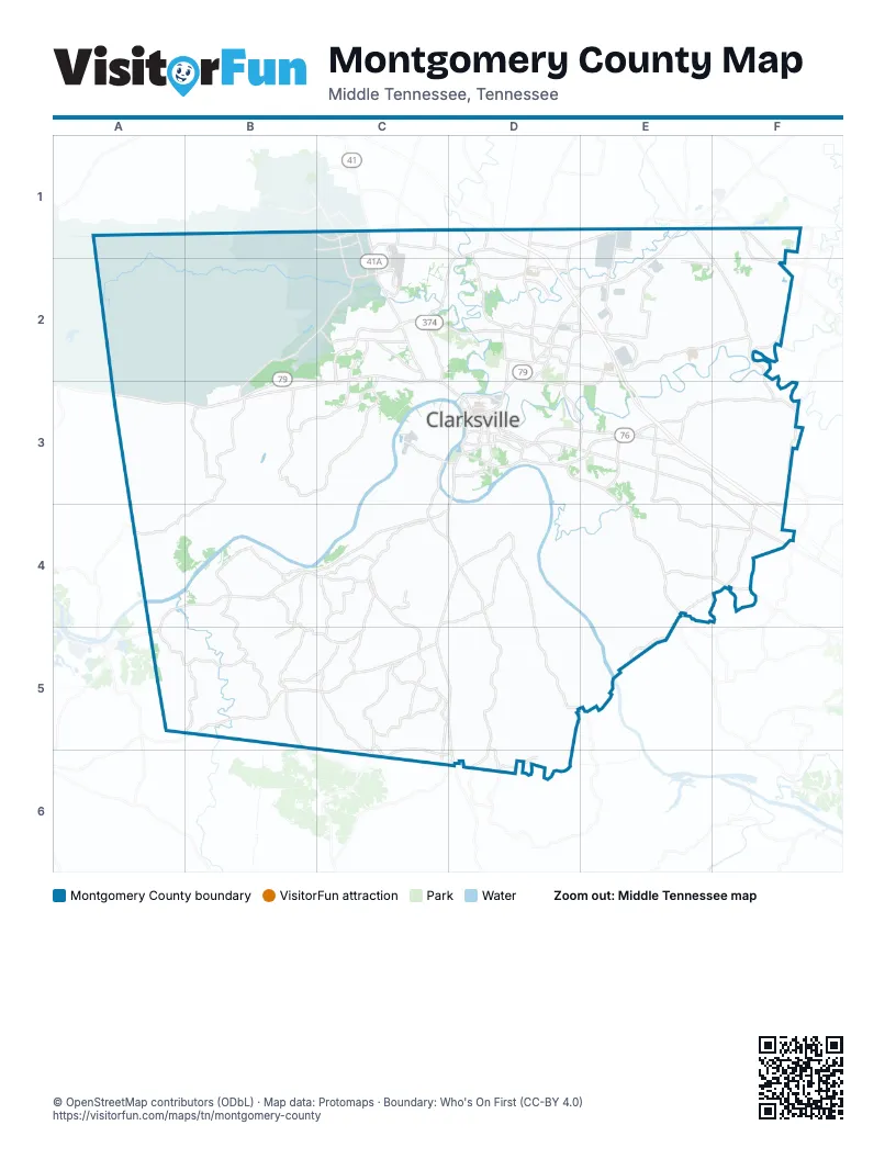
Street index of Montgomery County
Each street on the sheet and the grid squares it crosses.
- Fort Campbell BoulevardC1, C2
- Jackson RoadC1
- Outlaw Field RoadC1, C2
- Pembroke Oak Grove RoadC1
- Pembroke RoadC1
- Tiny Town RoadC1, D1
- Needmore RoadD1, D2
- Oakland RoadD1, D2, E2
- Peachers Mill RoadD1, C2, D2, C3
- Trenton RoadD1, D2
- Tylertown RoadD1, E1
- Guthrie HighwayE1, D2, E2
- Port Royal RoadE1, F2, F3
- Russellville RoadE1
- State StreetF1
- Dover RoadB2, C2, A3, B3, C3
- 101st Airborne Division ParkwayC2, D2
- Dotsonville RoadC2, C3
- Dover Crossing RoadC2, C3
- Jack Miller BoulevardC2
- Lady Marian DriveC2
- Lafayette RoadC2
- Paul B Huff Memorial ParkwayC2
- Providence BoulevardC2, C3, D3
- Purple Heart ParkwayC2
- Ringgold RoadC2
- Sinclair DriveC2
- South Liberty Church RoadC2, C3
- Tobacco RoadC2
- William C. Lee RoadC2
- Dunbar Cave RoadD2, E2, D3, E3
- Holiday DriveD2
- Old Trenton RoadD2, D3
- Rossview RoadD2, E2, F2
- Spring Creek ParkwayD2
- Ted A. Crozier BoulevardD2, E2
- Ted A. Crozier. Sr. BoulevardD2, E2
- Warfield BoulevardD2, D3, E3
- Whitfield RoadD2
- Wilma Rudolph BoulevardD2, D3
- Dunlop LaneE2
- International BoulevardE2
- International BoulvardE2
- Lylewood RoadB3, A4, B4
- River RoadC3, C4, D4
- York RoadC3
- Zinc Plant RoadC3, D3
- 8th StreetD3
- 9th StreetD3
- Ashland City RoadD3, E3, E4
- College StreetD3
- Crossland AvenueD3
- Cumberland DriveD3
- Edmondson Ferry RoadD3
- Franklin StreetD3
- Glendale DriveD3
- Greenwood AvenueD3
- Kraft StreetD3
- Madison StreetD3, E3, F3, F4
- Marion StreetD3
- McClure StreetD3
- Memorial DriveD3, E3
- North 2nd StreetD3
- North 3rd StreetD3
- North Riverside DriveD3
- Pageant LaneD3
- Richview RoadD3, E3
- South 10th StreetD3
- South 2nd StreetD3
- South 3rd StreetD3
- South Riverside DriveD3
- State Highway 13D3, C4, D4, B5, C5
- University AvenueD3
- Old Farmers RoadE3
- Sango RoadE3
- Trough Springs RoadE3
- Cumberland City RoadA4
- Hayes Ridge RoadA4
- Ashland City HighwayE4
- Marion RoadC5, C6
- State Highway 48C5, D5, D6
- Slayden-Marion RoadC6
Places on the map
- Airport
- Amazon BNA6
- American Snuff Company, LLC
- APSU Farm & Environmental Education Center
- Arthurs Court
- Ashland Hills
- Ashton Ridge at West Creek
- Austin Peay State University
- Austin Square Shopping Center
- Autumn Creek
- Autumn Creek Village
- Azalea Trace
- Ballygar
- Barkers Mill Elementary School
- Barkley Hills Estates
- Barnett Bowles Farm
- Barnett Farm
- Beachaven
- Beacon Hills
- Beech Grove
- Bel-Air Estates
- Bella Vista Manor
- Belle Forest
- Belleglade Mobile Home Community
- Bellgar
- Bellshire
- Belmont
- Belmont Heights
- Bentley Meadows
- Bi-County Solid Waste Management
- Billy Dunlop Park
- Birchwood
- Blue Sky Estates
- Bourne Place
- Boxcroft
- Boyd Acres
- Boyer Farms
- Brentwood
- Bridgestone
- Britton Springs Estates
© OpenStreetMap contributors (ODbL) · Map data: Protomaps · Boundary: Who's On First (CC-BY 4.0)