

Texas road map
I-2 in Texas map
I-2 is about 45 miles in Texas. It has 49 exits, from Exit 128B at mile 0 to Exit 176 at mile 45. It meets 6 highways; US 83, TX 364 and TX 107 meet it in the most grid squares.
Open the map (PDF, US Letter)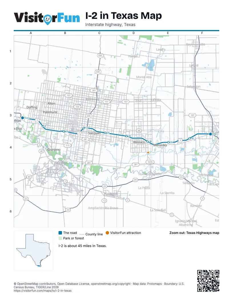
Exits on I-2 in Texas
Each exit in mile order, with its grid square.
- Exit 128Bmile 0, A3
- Exit 131mile 0, A3
- Exit 130mile 1, A3
- Exit 134mile 4, A3
- Exit 133mile 4, A3
- Exit 135mile 6, A3
- Exit 136mile 7, B3
- Exit 138mile 7, B3
- Exit 137mile 9, B3
- Exit 141mile 10, B4
- Exit 140mile 11, B4
- Exit 141Bmile 11, B4
- Exit 141Amile 12, B4
- Exit 143Amile 12, B4
- Exit 142mile 13, B4
- Exit 143Bmile 13, B4
- Exit 144mile 13, B4
- Exit 146Bmile 15, C3
- Exit 146Cmile 16, C3
- Exit 146Amile 16, C3
- Exit 147Bmile 19, C4
- Exit 149mile 19, C4
- Exit 150Amile 20, C4
- Exit 150Bmile 22, C4
- Exit 153mile 22, C4
- Exit 152mile 23, D4
- Exit 155Amile 24, D4
- Exit 154mile 25, D4
- Exit 155Bmile 25, D4
- Exit 157mile 26, D4
- Exit 159mile 28, D4
- Exit 158mile 29, D4
- Exit 161mile 30, D4
- Exit 160mile 31, E4
- Exit 163Amile 31, E4
- Exit 163Bmile 32, E4
- Exit 164mile 33, E4
- Exit 166mile 35, E4
- Exit 165mile 36, E4
- Exit 167mile 37, E4
- Exit 168mile 38, E4
- Exit 169mile 40, F4
- Exit 170mile 41, F4
- Exit 171mile 42, F4
- Exit 172mile 43, F4
- Exit 173mile 44, F4
- Exit 174mile 44, F4
- Exit 175mile 44, F4
- Exit 176mile 45, F4
Highways I-2 meets
Each highway it meets and the grid squares where they meet.
- US 83A3, D4
- TX 364A3
- TX 107A3
- TX 396B3
- TX 336B4
- US 281C3
Towns along I-2 in Texas
In mile order, with the grid square of each.
- Abrammile 0, A3
- Perezvillemile 0, A3
- Palmviewmile 1, A3
- La Homamile 3, A3
- Missionmile 3, A3
- McAllenmile 9, B3
- Pharrmile 13, B4
- San Juanmile 17, C3
- North Alamomile 19, C4
- Alamomile 19, C4
- Donnamile 22, C4
- Midway Northmile 25, D4
- Midway Southmile 26, D4
- Weslacomile 26, D4
- Mercedesmile 31, E4
- Heidelbergmile 33, E4
- Bixbymile 36, E4
- La Feriamile 37, E4
- Solismile 37, E4
- La Feria Northmile 38, E4
- Harlingenmile 41, F4
- Palm Valleymile 43, F4
- Las Palmas IImile 44, F4
- Juarezmile 44, F4
© OpenStreetMap contributors, Open Database License, openstreetmap.org/copyright · Map data: Protomaps · Boundary: U.S. Census Bureau, TIGER/Line 2026















