

Texas map
Montgomery County map
About 749,613 people live here (Census Bureau, 2024 estimate). The sheet's index lists 5 streets; Eastex Freeway, North Grand Parkway East and Aggie Expressway cross the most grid squares. Also on it: 336 Marketplace, Alden Bridge and Barton Woods.
Open the map (PDF, US Letter)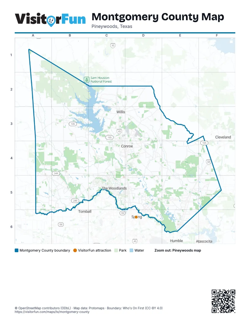
Street index of Montgomery County
Each street on the sheet and the grid squares it crosses.
- Aggie ExpresswayA4, B4, B5
- Eastex FreewayF4, E5, F5, E6
- MCTRA 249 TollwayB5
- Tomball TollwayB5
- North Grand Parkway EastD5, E5, F5, D6
Places on the map
- 336 Marketplace
- Alden Bridge
- Barton Woods
- Bear Branch Reservoir
- Benders Landing
- Bentwater
- Bird Lake
- Bluejack National Golf Club
- Carl Barton Jr Park
- Carlton Woods
- Chancery Place
- Chennault Airfield
- Cochran's Crossing
- College Park
- Conroe
- Copper Sage
- Creekside Village
- Crockett Trace
- Cut and Shoot
- Forest Trace Court
- Forest Village
- Forrest Hills Lake
- Gary Player Signature Course
- Golden Sage
- Grand Lake
- Grand Lake Estates
- Grand Pines Golf Club
- Grogan's Mill
- Grogan's Point
- Harper's Reserve
- Heritage Lake
- High Meadow Ranch
- High Meadow Ranch Golf Club
- High Meadow West
- High Oaks
- Highland Pines Golf Club
- Highland Ranch Gated Community
- Hollymead
- Huntsman Performance Products
- Indian Springs
Next to Montgomery County
- Atascocita
- Cleveland
- Humble
- Spring
- Tomball
© OpenStreetMap contributors (ODbL) · Map data: Protomaps · Boundary: Who's On First (CC-BY 4.0)