

Texas map
Piney Woods map
The sheet's index lists 15 highways; US 59, I-20 and I-30 cross the most grid squares. Things to do inside the boundary: Caddo Mounds State Historic Site, Caldwell Zoo and Huntsville State Park. Also on it: Atlanta, Center and Cleveland.
Open the map (PDF, US Letter)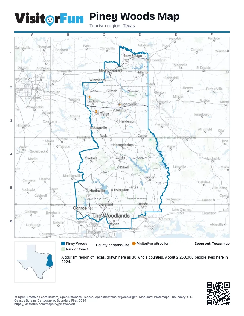
Highway index of Piney Woods
Each highway on the sheet and the grid squares it crosses.
- I-20B3, C3, D3
- I-30C1, C2, D1
- I-45B5, C5, C6
- I-69C6
- I-369D1
- US 59C4, C5, C6, D1
- US 69D6
- US 80D3
- US 96D6
- US 190B5
- US 259C3
- US 271C2
- US 287D6
- TX 99C6
- TX 249B6
Things to do on the Piney Woods map
- Caddo Mounds State Historic Site
- Caldwell Zoo
- Huntsville State Park
- Longview Museum of Fine Arts
- Mineola Historical Museum
- Mission Dolores State Historic Site
- Northeast Texas
- Northeast Texas Rural Heritage Center and Museum
- Sam Houston Memorial Museum
- Starr Family Home State Historic Site
- The Woodlands Mall
- Tyler Rose Museum
Places on the map
- Atlanta
- Center
- Cleveland
- Conroe
- Crockett
- Dayton
- Diboll
- Gilmer
- Henderson
- Huntsville
- Jacksonville
- Jasper
- Kilgore
- Lindale
- Livingston
- Longview
- Lufkin
- Mount Pleasant
- Nacogdoches
- New Boston
- Rusk
- Silsbee
- The Woodlands
- Tyler
- Winnsboro
Next to Piney Woods
- Arkansas Timberlands
- Cajun Country
- Crossroads
- Sportsman's Paradise
- Choctaw Country
- Gulf Coast map
- Prairies and Lakes map
© OpenStreetMap contributors, Open Database License, openstreetmap.org/copyright · Map data: Protomaps · Boundary: U.S. Census Bureau, Cartographic Boundary Files 2024