

Texas map
Nueces County map
About 353,125 people live here (Census Bureau, 2024 estimate). The sheet's index lists 10 streets; U.S. Highway 77, South Padre Island Drive and North Padre Island Drive cross the most grid squares. Things to do inside the boundary: Corpus Christi, Texas State Aquarium and USS Lexington Museum.
Open the map (PDF, US Letter)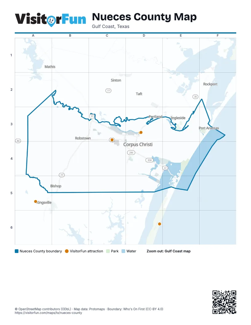
Maps inside Nueces County
1 map inside, from the street map of Nueces County down.
Street index of Nueces County
Each street on the sheet and the grid squares it crosses.
- U.S. Highway 77B3, C3, B4, B5
- I37C3
- North Padre Island DriveC3, C4
- State Highway 44C3
- Crosstown ExpresswayD3, D4
- New Harbor BridgeD3
- Nueces Bay CausewayD3
- Driscoll BypassB4
- South Padre Island DriveC4, D4, E4
- John F Kennedy Memorial CausewayE4
Things to do on the Nueces County map
Places on the map
- Agua Dulce
- Aqua Dulce Natural Gas Hub
- Aransas Pass
- Barney M Davis Reservoir
- Bill Witt City Park
- Bishop
- Brawner Parkway
- Cabaniss Athletic Complex
- CC Polymers
- Celanese Bishop Facility
- Cinnamon Shore South
- Corpus Christi
- Corpus Christi North Beach
- Cuddihy Field
- Driscoll
- Epic Crude Pipeline
- Fish Pass
- Flynn Shea Parkway
- Francine Cohn Preserve
- Gabe Lozano Golf Course
- Harbor Island
- Holiday Beach
- Horseshoe BUS
- I B Magee Beach Park
- Industrial Corridor BUS
- J P Luby
- Lake Padre
- Lost Creek
- Louisiana Parkway
- Martin Marietta
- Naval Outlying Landing Field Cabaniss
- New Port Pass
- Nueces County
- Nustar Energy
- Odem Bay
- Oso Bay
- Oso Bay Wetlands Preserve
- Oso Creek Park
- Packery Channel City Park
- Padre Balli Park
Next to Nueces County
- Aransas Pass
- Ingleside
- Kingsville
- Mathis
- Portland
- Rockport
- Sinton
- Taft
© OpenStreetMap contributors (ODbL) · Map data: Protomaps · Boundary: Who's On First (CC-BY 4.0)