

United States map
East South Central States map
The sheet's index lists 15 highways; I-65, I-59 and I-75 cross the most grid squares. Also on it: Anniston, Auburn and Birmingham.
Open the map (PDF, US Letter)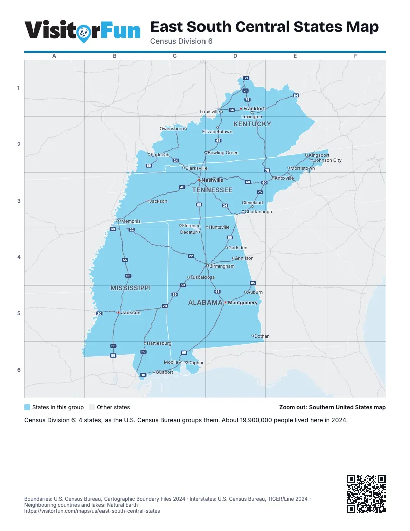
Highway index of East South Central States
Each highway on the sheet and the grid squares it crosses.
- I-10B6, C6
- I-20B5, C4, C5, D4
- I-22B3, B4, C4, D4
- I-24C2, C3, D3
- I-26E2, E3
- I-40B3, C3, D3, E3
- I-55B3, B4, B5, B6
- I-59B5, B6, C4, C5, C6, D3, D4
- I-64D1, E1
- I-65C2, C3, C4, C5, C6, D1, D2, D4, D5
- I-69B3, B4, C2
- I-71D1
- I-75D1, D2, D3, E2, E3
- I-81E2, E3
- I-85D4, D5
Places on the map
- Anniston
- Auburn
- Birmingham
- Bowling Green
- Chattanooga
- Clarksville
- Cleveland
- Daphne
- Decatur
- Dothan
- Elizabethtown
- Florence
- Frankfort
- Gadsden
- Gulfport
- Hattiesburg
- Huntsville
- Jackson
- Jackson
- Johnson City
- Kingsport
- Knoxville
- Lexington
- Louisville
- Memphis
- Mobile
- Montgomery
- Morristown
- Nashville
- Owensboro
- Paducah
- Tuscaloosa
Boundaries: U.S. Census Bureau, Cartographic Boundary Files 2024 · Interstates: U.S. Census Bureau, TIGER/Line 2024 · Neighbouring countries and lakes: Natural Earth















