

United States map
West South Central States map
The sheet's index lists 16 highways; I-10, I-20 and I-35 cross the most grid squares. Also on it: Abilene, Alexandria and Amarillo.
Open the map (PDF, US Letter)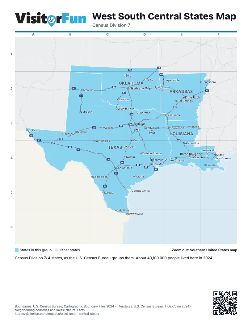
Highway index of West South Central States
Each highway on the sheet and the grid squares it crosses.
- I-2C6
- I-10A3, A4, B4, C4, D4, E4, F4
- I-12E4, F4
- I-14C4, D4
- I-20B3, B4, C3, D3, E3, F3
- I-27B2, B3
- I-30D3, E2, E3
- I-35C4, C5, D1, D2, D3, D4
- I-37C4, C5, D5
- I-40B2, C2, D2, E2, F2
- I-44C2, C3, D1, D2
- I-45D3, D4
- I-49D2, E2, E3, E4
- I-55F2, F4
- I-59F4
- I-69C6, D4, D6
Places on the map
- Abilene
- Alexandria
- Amarillo
- Austin
- Baton Rouge
- Beaumont
- Brownsville
- College Station
- Corpus Christi
- Dallas
- Eagle Pass
- El Paso
- Enid
- Fayetteville
- Fort Smith
- Hammond
- Hot Springs
- Houma
- Houston
- Jonesboro
- Killeen
- Lafayette
- Lake Charles
- Laredo
- Lawton
- Little Rock
- Longview
- Lubbock
- McAllen
- Midland
- Monroe
- New Orleans
- Odessa
- Oklahoma City
- San Angelo
- San Antonio
- Sherman
- Shreveport
- Slidell
- Texarkana
- Tulsa
- Tyler
- Victoria
- Waco
- Wichita Falls
Boundaries: U.S. Census Bureau, Cartographic Boundary Files 2024 · Interstates: U.S. Census Bureau, TIGER/Line 2024 · Neighbouring countries and lakes: Natural Earth















