

Utah road map
I-84 in Utah map
I-84 is about 117 miles in Utah. It meets 20 highways; I-15, UT 13 and UT 30 meet it in the most grid squares. Towns along it: Ogden, Roy and West Haven.
Open the map (PDF, US Letter)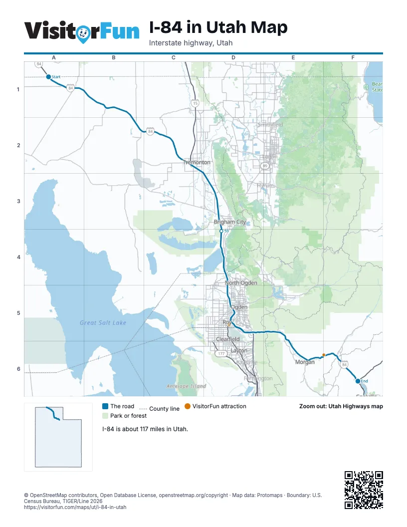
Highways I-84 meets
Each highway it meets and the grid squares where they meet.
- UT 30A1
- UT 83B2
- UT 102C2
- I-15C2, D3
- UT 13C2, D3
- UT 240D3
- US 91D3
- UT 315D4
- UT 126D4
- UT 134D4
- UT 104D5
- UT 53D5
- UT 79D5
- UT 60D5
- UT 26D5
- US 89D5
- UT 167E5
- UT 66E6
- UT 86F6
- UT 65F6
Towns along I-84 in Utah
In mile order, with the grid square of each.
- Snowvillemile 6, A1
- Howellmile 25, B2
- Tremontonmile 38, C2
- Elwoodmile 43, C2
- Honeyvillemile 46, D3
- Bear River Citymile 48, D3
- Brigham Citymile 53, D3
- Perrymile 58, D3
- Willardmile 62, D4
- South Willardmile 66, D4
- Farr Westmile 69, D4
- Pleasant Viewmile 69, D4
- Plain Citymile 70, D4
- Harrisvillemile 72, D5
- Ogdenmile 73, D5
- Marriott-Slatervillemile 73, D5
- West Havenmile 75, D5
- Riverdalemile 79, D5
- Roymile 79, D5
- Washington Terracemile 80, D5
- South Webermile 83, D5
- South Ogdenmile 83, D5
- Uintahmile 84, D5
- Mountain Greenmile 91, E5
- Enterprisemile 95, E5
- Morganmile 100, E6
- Henefermile 112, F6
- Echomile 116, F6
Things to do on the I-84 in Utah map
© OpenStreetMap contributors, Open Database License, openstreetmap.org/copyright · Map data: Protomaps · Boundary: U.S. Census Bureau, TIGER/Line 2026















