

Utah road map
Trail of the Ancients map
The Trail of the Ancients has been a National Scenic Byway since 2005, named for its archaeological qualities: about 330 miles in Utah and Colorado. It meets 12 highways, among them US 160, US 163 and US 191. Towns along it: Cortez, Blanding and Monticello.
Open the map (PDF, US Letter)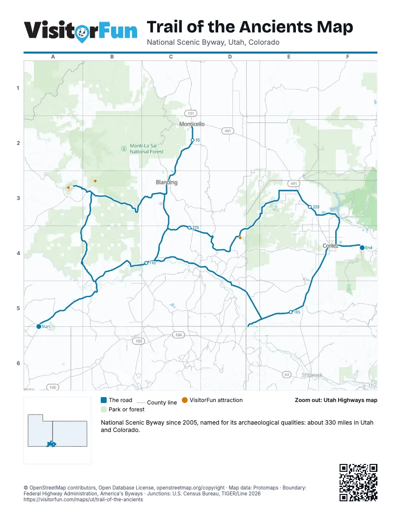
Highways it meets
Each highway it meets and the grid squares where they meet.
- US 163A5
- US 191C4
- UT 262C3
- US 491B3
- UT 95B3
- UT 261B3
- UT 162C4
- CO 41D5
- US 160E5
- CO 145F4
- CO 184F3
- UT 275B3
Towns along the Trail of the Ancients
In mile order, with the grid square of each.
- Oljato-Monument Valleymile 0, A5
- Halchitamile 14, A5
- Mexican Hatmile 21, B5
- Bluffmile 25, C4
- Blandingmile 35, C3
- Monticellomile 59, C2
- Tselakai Dezzamile 108, B4
- Montezuma Creekmile 124, C4
- Anethmile 134, D4
- Towaocmile 177, E5
- Cortezmile 188, F4
- Lewismile 216, F3
- White Mesamile 278, C4
Things to do on the Trail of the Ancients map
© OpenStreetMap contributors, Open Database License, openstreetmap.org/copyright · Map data: Protomaps · Boundary: Federal Highway Administration, America's Byways · Junctions: U.S. Census Bureau, TIGER/Line 2026















