

Virginia map
Loudoun County map
About 443,380 people live here (Census Bureau, 2024 estimate). The sheet's index lists 9 streets; Leesburg Pike, Dulles Greenway and East Market Street cross the most grid squares. Also on it: 1757 Golf Club, ADESA Washington D.C. and Aldie.
Open the map (PDF, US Letter)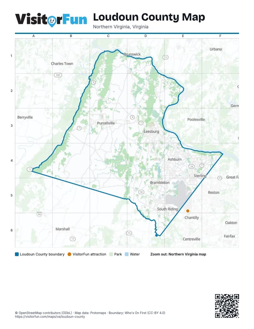
Maps inside Loudoun County
1 map inside, from the street map of Loudoun County down.
Street index of Loudoun County
Each street on the sheet and the grid squares it crosses.
- Leesburg PikeB3, C3, D3, E3, E4
- Dulles GreenwayD3, D4, E4, E5
- East Market StreetD3, E3
- Leesburg BypassD3
- Harry Byrd HighwayE4
- Leesburg PIkeE4
- Sully RoadE4, E5
- Dulles Access RoadE5
- Dulles Toll RoadE5
Places on the map
- 1757 Golf Club
- ADESA Washington D.C.
- Aldie
- Algonkian Regional Park
- Amazing Farm Fun
- Arcola
- Ashbrook Village
- Ashburn
- Ashburn Crossing
- Ashburn Lake
- Ashby Ponds
- AWS
- Banshee Reeks Nature Preserve
- Bazil Newman Riverfront Park
- Beaureguard Estates
- Beaverdam Reservoir
- Belmont
- Belmont Greene
- Birchwood at Brambleton
- Blue Ridge Regional Park
- Brambleton
- Brambleton Golf Club
- Broadlands
- Bull Run Quarry
- Cameron Chase
- Cardinal Glen
- Cascades
- Cascades Estates
- Cattail Run
- Cedar Ridge
- Chantilly Crushed Stone
- Claude Moore Park
- Compass Creek
- Coton Commons
- Countryside
- Creighton Farms Golf Club
- Crooked Run Orchard
- Dawsons' Corner
- Digital Loudoun Plaza
- Dulles Landing
Next to Loudoun County
- Berryville
- Brunswick
- Centreville
- Chantilly
- Charles Town
- Fairfax
- Great Falls
- Marshall
- Oakton
- Poolesville
- Reston
- Urbana
© OpenStreetMap contributors (ODbL) · Map data: Protomaps · Boundary: Who's On First (CC-BY 4.0)