

Visitor map
Map of the Wildwoods, NJ
The 2023 print map of the Wildwoods on the Jersey Shore, as a PDF. Open it in the browser, print it, or save it to your phone, then plan the day with the Jersey Shore guide below.
Open the map (PDF)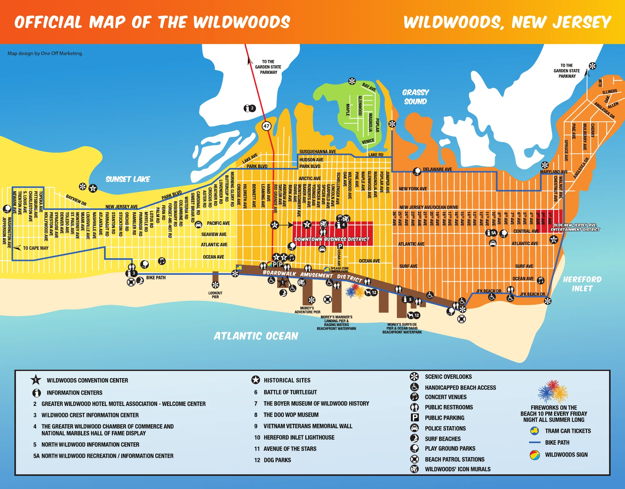
About this map
The official 2023 map of the Wildwoods on the Jersey Shore: the island from Wildwood Crest through Wildwood to North Wildwood, between the Atlantic Ocean and Grassy Sound, with the streets and avenues named.
It marks the Boardwalk Amusement District and Morey's piers, the downtown business district, the bike path, beaches with accessible entrances, information centers, public restrooms and parking, and the historical sites, from the Doo Wop Museum to the Hereford Inlet Lighthouse. A note on the map says there are fireworks on the beach at 10 PM every Friday night all summer.
Historical sites on the map
- Battle of Turtlegut
- The Boyer Museum of Wildwood History
- The Doo Wop Museum
- Vietnam Veterans Memorial Wall
- Hereford Inlet Lighthouse
- Avenue of the Stars
Information centers on the map
- Greater Wildwood Hotel Motel Association Welcome Center
- Wildwood Crest Information Center
- Greater Wildwood Chamber of Commerce and National Marbles Hall of Fame display
- North Wildwood Information Center
- North Wildwood Recreation and Information Center















