

West Virginia road map
Midland Trail map
The Midland Trail has been a National Scenic Byway since 2000, named for its recreational qualities: about 113 miles in West Virginia. It meets 12 highways, among them I-64, I-77 and US 19. Towns along it: Charleston, Lewisburg and Fayetteville.
Open the map (PDF, US Letter)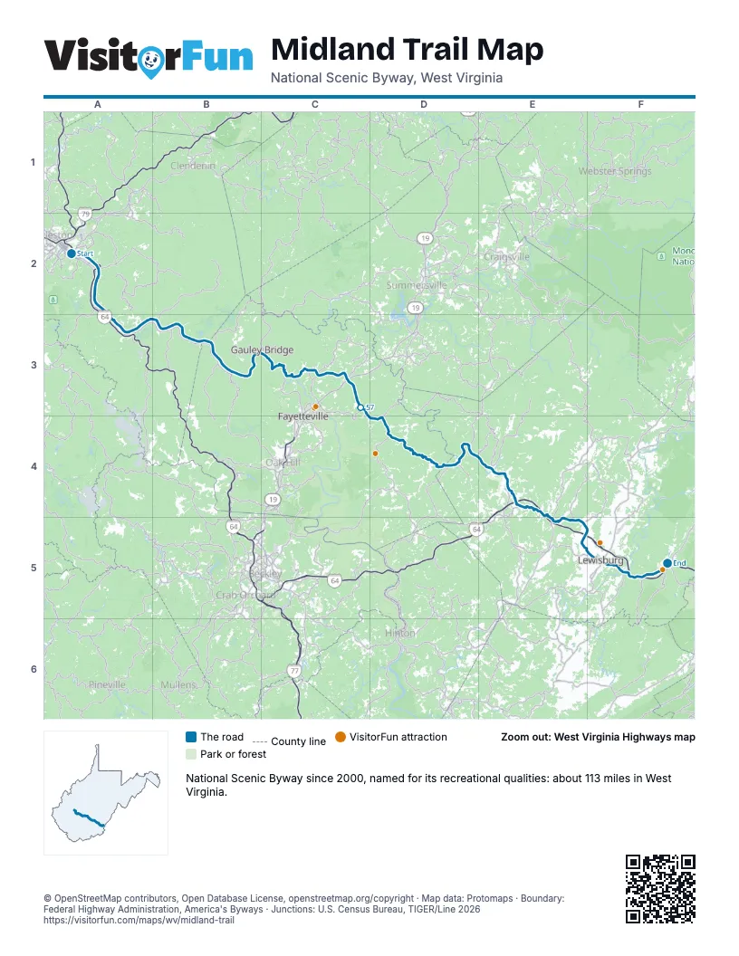
Highways it meets
Each highway it meets and the grid squares where they meet.
- US 60A2
- WV 114A2
- I-64A2
- I-77A2
- WV 6B3
- WV 16C3
- US 19C3
- WV 41D4
- WV 20D4
- WV 12E5
- US 219F5
- WV 63F5
Towns along the Midland Trail
In mile order, with the grid square of each.
- Charlestonmile 0, A2
- Coal Forkmile 4, A2
- Maldenmile 5, A2
- Randmile 6, A2
- Dupont Citymile 8, A2
- Marmetmile 9, A2
- Bellemile 10, A2
- Shrewsburymile 17, A3
- East Bankmile 18, A3
- Cedar Grovemile 20, B3
- Glasgowmile 20, B3
- Hollygrovemile 21, B3
- Prattmile 23, B3
- Handleymile 23, B3
- Montgomerymile 27, B3
- Smithersmile 29, B3
- Boomermile 31, B3
- Kimberlymile 31, B3
- Falls Viewmile 33, B3
- Charlton Heightsmile 35, B3
- Glen Ferrismile 37, B3
- Gauley Bridgemile 38, B3
- Fayettevillemile 44, C3
- Anstedmile 45, C3
- Hicomile 51, C3
- Rainellemile 72, D4
- Rupertmile 79, E4
- Lewisburgmile 102, F5
- Fairleamile 102, F5
- White Sulphur Springsmile 113, F5
© OpenStreetMap contributors, Open Database License, openstreetmap.org/copyright · Map data: Protomaps · Boundary: Federal Highway Administration, America's Byways · Junctions: U.S. Census Bureau, TIGER/Line 2026