

West Virginia road map
West Virginia highway map
7 Interstate routes run about 562 miles in West Virginia, each on a sheet of its own. The sheet's index lists 22 highways; I-77, I-79 and I-64 cross the most grid squares. Towns on it: Charleston, Huntington and Morgantown.
Open the map (PDF, US Letter)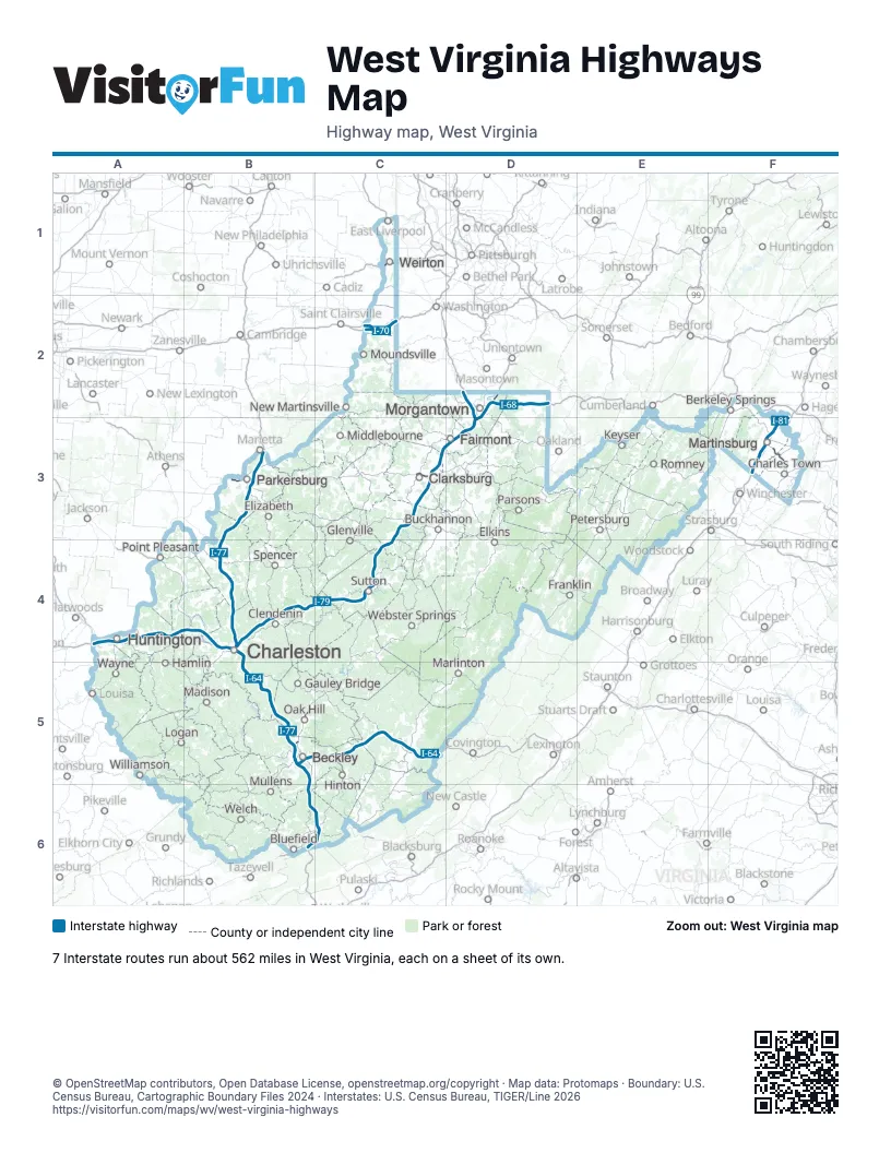
Road maps of West Virginia
7 road maps: each Interstate and byway on a sheet of its own.
Highway index of West Virginia
Each highway on the sheet and the grid squares it crosses.
- I-64A4, B4, B5, C5
- I-68D2, D3
- I-70C2
- I-77B3, B4, B5, B6, C6
- I-79B4, C3, C4, D2, D3
- I-81F3
- I-470C2
- US 19B5, C4
- US 22C1
- US 30C1
- US 33B4
- US 35A4
- US 40C2
- US 50B3, C3
- US 52A4, B6
- US 60B4, C5
- US 250C2
- WV 2B3, B4, C1, C2
- SR 7C2
- WV 9F3
- WV 43D2
- WV 68B3
Places on the map
- Beckley
- Berkeley Springs
- Bluefield
- Buckhannon
- Charles Town
- Charleston
- Clarksburg
- Clendenin
- Elizabeth
- Elkins
- Fairmont
- Franklin
- Gauley Bridge
- Glenville
- Hamlin
- Hinton
- Huntington
- Keyser
- Logan
- Madison
- Marlinton
- Martinsburg
- Middlebourne
- Morgantown
- Moundsville
- Mullens
- New Martinsville
- Oak Hill
- Parkersburg
- Parsons
- Petersburg
- Point Pleasant
- Romney
- Spencer
- Sutton
- Wayne
- Webster Springs
- Weirton
- Welch
- Williamson
© OpenStreetMap contributors, Open Database License, openstreetmap.org/copyright · Map data: Protomaps · Boundary: U.S. Census Bureau, Cartographic Boundary Files 2024 · Interstates: U.S. Census Bureau, TIGER/Line 2026