

Wyoming map
Southwest Wyoming map
The sheet's index lists 12 highways; I-80, US 30 and US 191 cross the most grid squares. Things to do inside the boundary: Fossil Butte National Monument, Museum of the Mountain Man and White Mountain Mall. Also on it: Afton, Alpine and Evanston.
Open the map (PDF, US Letter)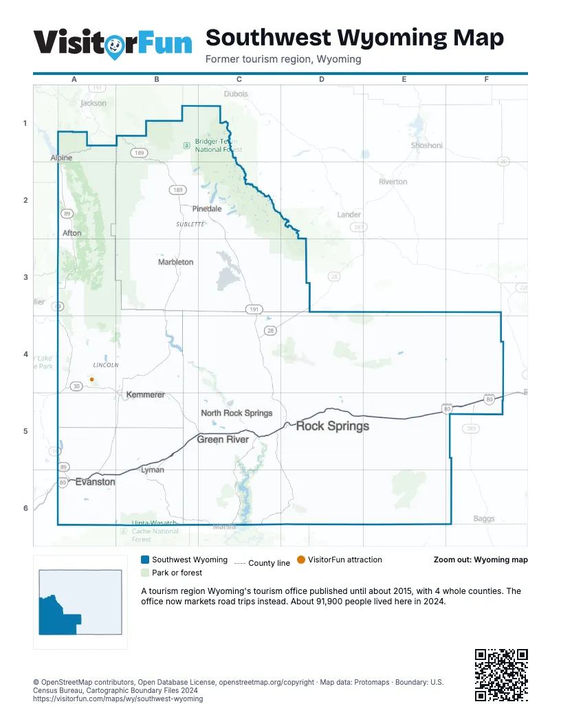
Highway index of Southwest Wyoming
Each highway on the sheet and the grid squares it crosses.
- I-80A6, B5, B6, C5, D5, E5, F5
- US 26A1
- US 30A4, B4, B5, C5, D5, E5, F5
- US 89A1, A2, A3
- US 189A6, B1, B2
- US 191B1, B2, C2, C3, C4, C5, D5
- SR 16A5
- WY 28C4, D3, D4
- SR 30A5
- WY 89A3, A4, A5, A6
- WY 150A6
- WY 789F5
Things to do on the Southwest Wyoming map
Places on the map
- Afton
- Alpine
- Evanston
- Green River
- Kemmerer
- Lyman
- Marbleton
- North Rock Springs
- Pinedale
- Rock Springs
Next to Southwest Wyoming
- The Great West
- Eastern Idaho
- Southeast Idaho
- Eastern Utah
- North Mountains
- Northwest Wyoming
- Southeast Wyoming map
© OpenStreetMap contributors, Open Database License, openstreetmap.org/copyright · Map data: Protomaps · Boundary: U.S. Census Bureau, Cartographic Boundary Files 2024