

Alabama road map
I-459 in Alabama map
I-459 is about 32 miles in Alabama. It has 14 exits, from Exit 1 at mile 1 to Exit 32 at mile 32. It meets 9 highways, among them I-20, I-65 and US 31.
Open the map (PDF, US Letter)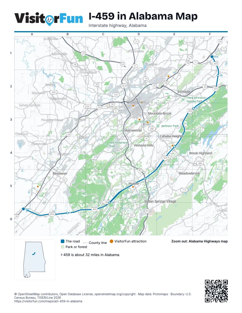
Exits on I-459 in Alabama
Each exit in mile order, with its grid square.
- Exit 1mile 1, A6
- Exit 6mile 6, B6
- Exit 10mile 10, C6
- Exit 13mile 13, D5
- Exit 13Amile 14, D5
- Exit 13Bmile 14, D5
- Exit 15mile 15, D5
- Exit 17mile 17, E4
- Exit 19mile 20, E4
- Exit 23mile 23, E3
- Exit 27mile 27, F2
- Exit 29mile 28, F2
- Exit 31mile 31, F1
- Exit 32mile 32, F1
Highways I-459 meets
Each highway it meets and the grid squares where they meet.
- AL 150C6
- US 31D5
- AL 3D5
- I-65D5
- US 280E4
- AL 38E4
- I-20F2
- US 78F2
- AL 4F2
Towns along I-459 in Alabama
In mile order, with the grid square of each.
- McCallamile 0, A6
- Bessemermile 0, A6
- Hoovermile 7, B6
- Vestavia Hillsmile 15, D5
- Birminghammile 19, E4
- Mountain Brookmile 19, E4
- Irondalemile 24, E3
- Trussvillemile 30, F2
Things to do on the I-459 in Alabama map
© OpenStreetMap contributors, Open Database License, openstreetmap.org/copyright · Map data: Protomaps · Boundary: U.S. Census Bureau, TIGER/Line 2026