

Arkansas map
Arkansas Timberlands map
The sheet's index lists 30 highways; US 425, US 79 and US 82 cross the most grid squares. Things to do inside the boundary: Arkansas Land of Legends, Arts and Science Center for Southeast Arkansas and Conway Cemetery State Park. Also on it: Ashdown, Camden and Crossett.
Open the map (PDF, US Letter)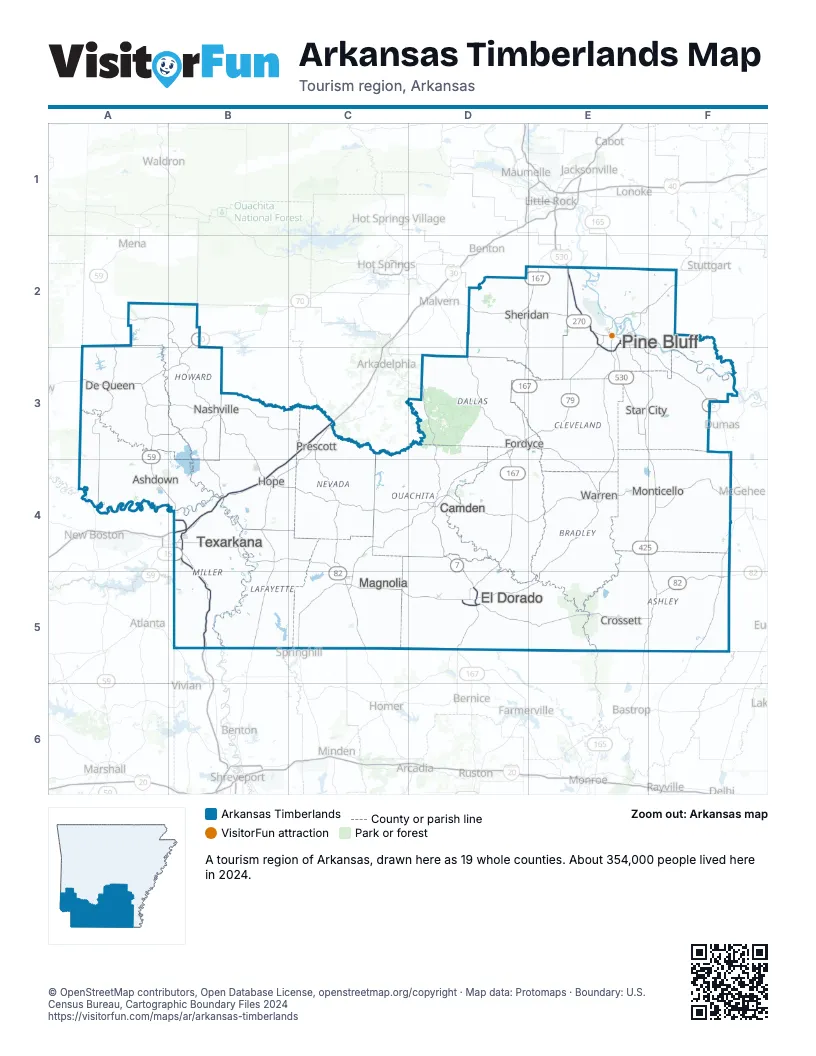
Highway index of Arkansas Timberlands
Each highway on the sheet and the grid squares it crosses.
- I-30B4, C3
- I-49B4, B5
- I-530E2, E3
- US 59A2, A3, A4, B4
- US 63D5, E2, E3, F2
- US 65E2, E3, F3, F4
- US 65BE2
- US 70A3, B2, B3
- US 71A2, A3, A4, B4
- US 79C5, D3, D4, E2, E3, F2
- US 79BE2
- US 82B4, C4, C5, D5, E5, F5
- US 165F3, F4
- US 167D2, D3, D4, D5, E2
- US 167BD5
- US 270D2, E2
- US 278B3, B4, C4, D4, E4, F4
- US 371A3, B3, C4
- US 425E2, E3, E4, E5, F3, F4, F5
- AR 4B3
- AR 7D4, D5
- AR 8E4, F4, F5
- AR 11E3
- AR 27B3
- AR 29B4
- AR 32BA4
- AR 133E5
- AR 133TE5
- AR 151B4
- AR 530E3
Things to do on the Arkansas Timberlands map
Places on the map
- Ashdown
- Camden
- Crossett
- De Queen
- El Dorado
- Fordyce
- Hope
- Magnolia
- Monticello
- Nashville
- Pine Bluff
- Prescott
- Sheridan
- Star City
- Texarkana
- Warren
Next to Arkansas Timberlands
- Arkansas Capital map
- Arkansas Delta map
- Arkansas Ouachitas map
- Sportsman's Paradise
- Choctaw Country
- Piney Woods
© OpenStreetMap contributors, Open Database License, openstreetmap.org/copyright · Map data: Protomaps · Boundary: U.S. Census Bureau, Cartographic Boundary Files 2024