

Arkansas map
Arkansas Capital map
The sheet's index lists 17 highways; US 167, I-57 and US 64 cross the most grid squares. Things to do inside the boundary: Arkansas Museum of Fine Arts, Little Rock Central High School National Historic Site and Little Rock National Cemetery. Also on it: Beebe, Benton and Cabot.
Open the map (PDF, US Letter)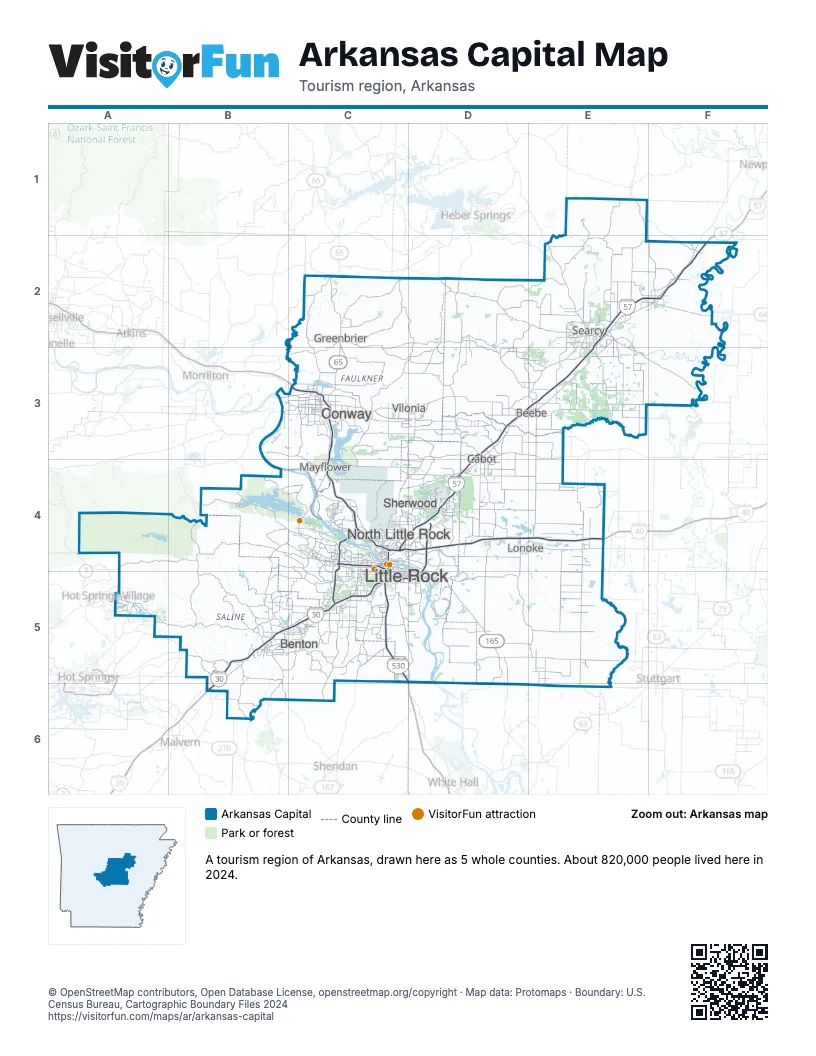
Highway index of Arkansas Capital
Each highway on the sheet and the grid squares it crosses.
- I-30B5, B6, C4, C5
- I-40C3, C4, D4, E4
- I-57C4, D3, D4, E2, E3, F2
- I-430C4, C5
- I-440C5, D4, D5
- I-530C5, D5
- I-630C4
- US 64C3, D3, E2, E3, F2
- US 65C2, C3, C4, C5, D5
- US 65BC3
- US 67B5, C4, C5
- US 67BD3
- US 70B5, C5
- US 165C4, D4, D5, E5
- US 167C4, C5, D3, D4, E1, E2, E3, F2
- AR 15D5
- AR 25C2
Things to do on the Arkansas Capital map
- Arkansas Museum of Fine Arts
- Little Rock Central High School National Historic Site
- Little Rock National Cemetery
- Little Rock Zoo
- Mosaic Templars Cultural Center
- Museum of Discovery
- Old State House Museum
- Park Plaza Mall
- Pinnacle Mountain State Park
- River Market District
- William J. Clinton Presidential Library and Museum
Places on the map
- Beebe
- Benton
- Cabot
- Conway
- Greenbrier
- Little Rock
- Lonoke
- Mayflower
- North Little Rock
- Searcy
- Sherwood
- Vilonia
Next to Arkansas Capital
© OpenStreetMap contributors, Open Database License, openstreetmap.org/copyright · Map data: Protomaps · Boundary: U.S. Census Bureau, Cartographic Boundary Files 2024