

Arkansas map
Washington County map
About 266,184 people live here (Census Bureau, 2024 estimate). The sheet's index lists 3 streets; Springdale Northern Bypass, Fulbright Expressway and Bobby Hopper Tunnel cross the most grid squares. Things to do inside the boundary: Devil's Den State Park.
Open the map (PDF, US Letter)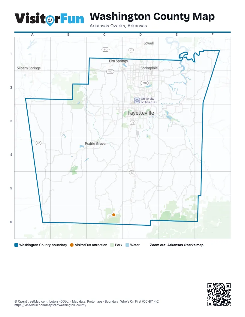
Street index of Washington County
Each street on the sheet and the grid squares it crosses.
- Springdale Northern BypassC1, C2
- Fulbright ExpresswayD2, D3
- Bobby Hopper TunnelD6
Things to do on the Washington County map
Places on the map
- Blessings Golf Club
- Bob Kidd Lake
- Brooklands at Mountain Ranch
- Covington Park
- Elkins
- Elm Springs
- Farmington Quarry
- Fayetteville
- Forest Hills
- Goshen
- Greenland
- Hyland Park
- JB Hunt Park
- Johnson
- Kessler Mountain Regional Park
- Lake Elmdale
- Lake Fayetteville
- Lake Fayetteville Park
- Lake Prairie Grove
- Lake Sequoyah
- Lake Sequoyah Park
- Lake Wedington
- Lake Wilson Park
- Lincoln
- Lincoln Lake
- Prairie Grove
- Riverwalk
- Southwinds
- Springdale
- Springdale Municipal Airport
- Stonebridge Meadows
- The Cliffs
- The Grove at Engles Mill
- The Villages of Sloanbrooke
- Tontitown
- Twin Falls
- University of Arkansas
- Washington County
- Waste Management Tontitown
- West Fork
Next to Washington County
- Lowell
- Siloam Springs
© OpenStreetMap contributors (ODbL) · Map data: Protomaps · Boundary: Who's On First (CC-BY 4.0)